[:ja]宇宙飛行士がISSから撮影した西アフリカのギニアビサウです。
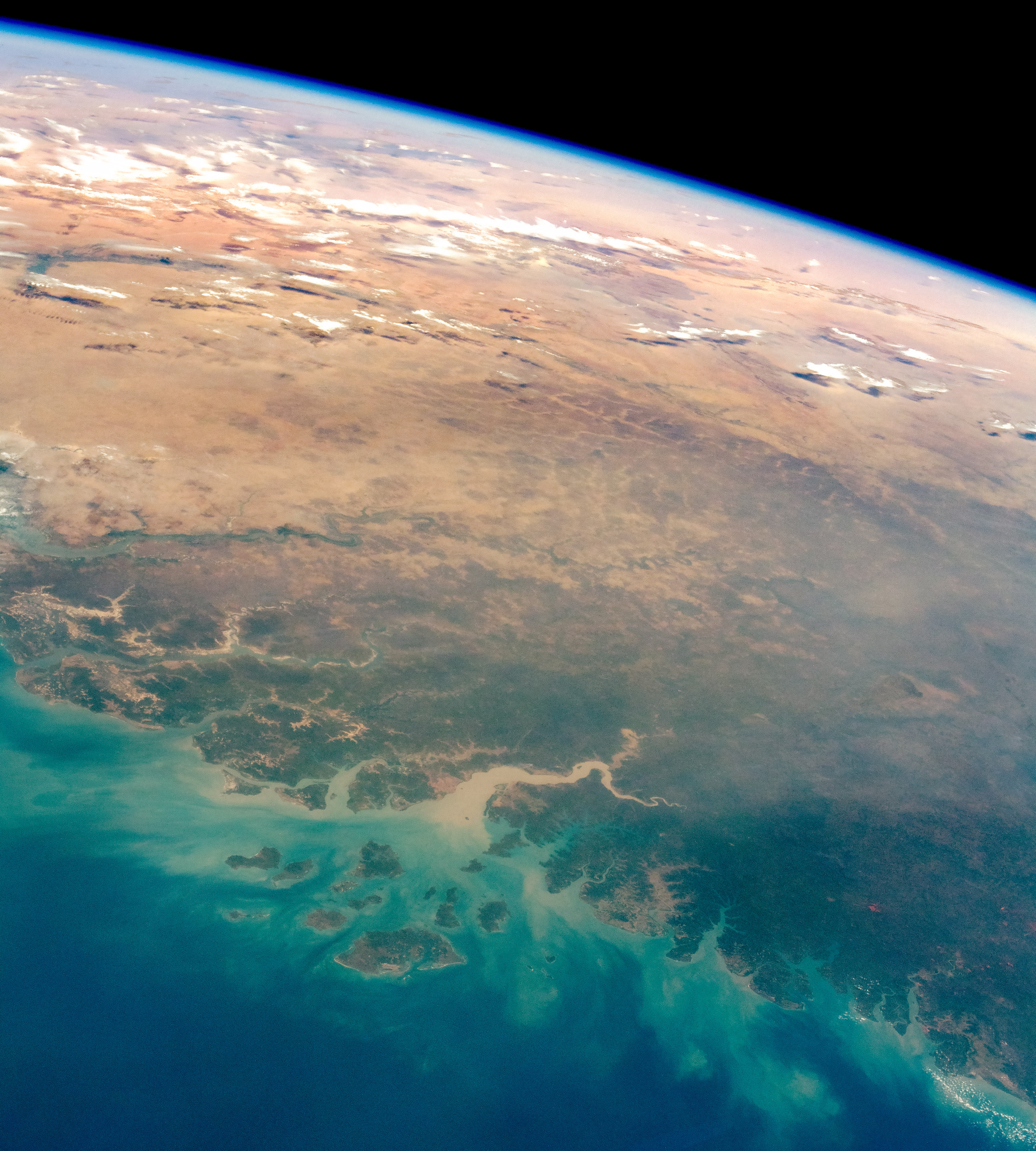
ギニアビサウは熱帯の小国で、いくつかの河川が流れる大陸部と島嶼部(ビジャゴ諸島)からなります。高い山は無く、国内の最高地点の標高は310mです。内陸部はサバンナで、沿岸部は沼沢地のところが多いです。ギニアビサウではカシューナッツや落花生が主な輸出品ですが、工業、鉱業がほぼ存在せず、労働力の8割が従事する主要産業の農業も米などの自給農業が中心でしかも国内需要すら満たせないほど生産性が低いです。企業家層がおらず、識字率も低いため経済発展の基礎的な条件が存在していない状況です。1446年にポルトガル人が上陸し、ポルトガルの植民地となった関係で、独立後の現在も公用語はポルトガル語です。
地上の様子はこちらです。

参考文献: Guinea-Bissau, the Sahel, and the Sahara Desert (NASA Earth Observatory)
地球俯瞰画像を見る: LiVEARTH
[Earthview Wonders] No.779: Guinea-Bissau🇬🇼
Astronauts captured from ISS Guinea-Bissau of west Africa.
Guinea-Bissau is bordered by Senegal to the north and Guinea to the south and east, with the Atlantic Ocean to its west. Guinea-Bissau is warm all year around and there is little temperature fluctuation; it averages 26.3°C. Its highest point is 310m, and the terrain of is mostly low coastal plain with swamps of Guinean mangroves rising to Guinean forest-savanna mosaic in the east. Only 14% of the population speaks noncreolized Portuguese, established as both the official and national language. The country’s per-capita gross domestic product is one of the lowest in the world.
The local scenery on the ground is as follows.
Reference: Guinea-Bissau, the Sahel, and the Sahara Desert (NASA Earth Observatory)
See earthview photo gallery: LiVEARTH[:en][Earthview Wonders] No.779: Guinea-Bissau🇬🇼
Astronauts captured from ISS Guinea-Bissau of west Africa.
Guinea-Bissau is bordered by Senegal to the north and Guinea to the south and east, with the Atlantic Ocean to its west. Guinea-Bissau is warm all year around and there is little temperature fluctuation; it averages 26.3°C. Its highest point is 310m, and the terrain of is mostly low coastal plain with swamps of Guinean mangroves rising to Guinean forest-savanna mosaic in the east. Only 14% of the population speaks noncreolized Portuguese, established as both the official and national language. The country’s per-capita gross domestic product is one of the lowest in the world.
The local scenery on the ground is as follows.
Reference: Guinea-Bissau, the Sahel, and the Sahara Desert (NASA Earth Observatory)
See earthview photo gallery: LiVEARTH[:]