[:ja]宇宙飛行士がISSから撮影したインドネシアのスラウェシ島です。
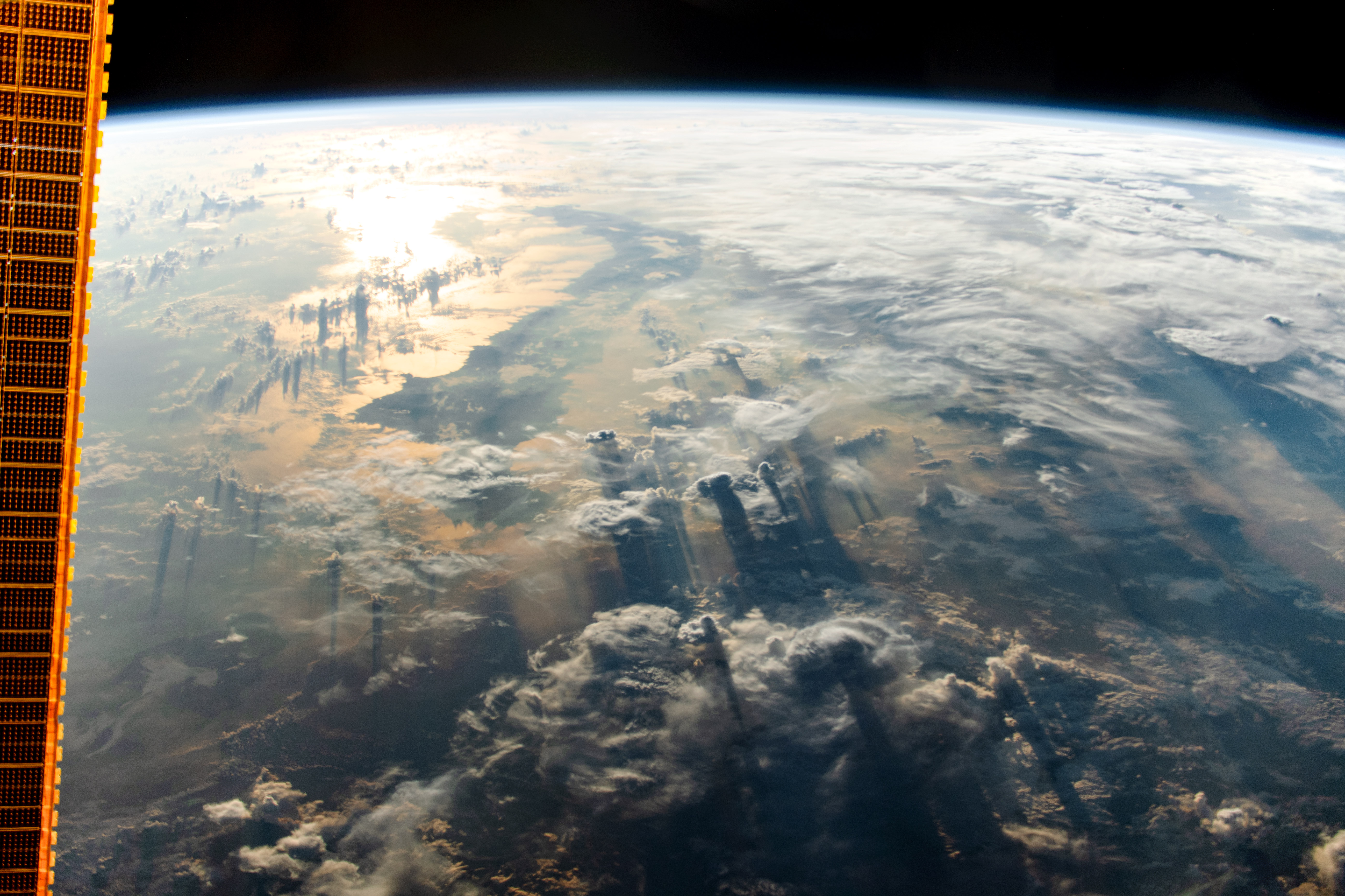
スラウェシ島は、インドネシア中部にある島で、世界第11位、インドネシアでは第4位の大きさを誇ります。環太平洋造山帯とアルプス・ヒマラヤ造山帯の合流点にあるため地形は複雑であり、特徴あるアルファベットのKの字のような形状をしています。山がちな地形であり、標高3,478mのラティモジョン山、トウティ湖等の湖もあるため、各地域は交流が少なく独自性が強くなり、長らく島としての一体性が弱かったです。島内の経済発展の大きな障害は交通インフラストラクチャーにあると考えられています。
地上の様子はこちらです。

参考文献: Cloudy Sulawesi (NASA Earth Observatory)
地球俯瞰画像を見る: LiVEARTH
[Earthview Wonders] No.822: Sulawesi, Indonesia🇮🇩
Astronaut on board ISS captured from ISS Sulawesi, Indonesia.
Sulawesi Island is one of the four Greater Sunda Islands in Indonesia, and the world’s eleventh-largest island. The central part of the island is ruggedly mountainous, such that the island’s peninsulas have traditionally been remote from each other, with better connections by sea than by road. According to plate reconstructions, the island is believed to have been formed by the collision of terranes from the Asian Plate and from the Australian Plate, with island arcs previously in the Pacific. Because of its several tectonic origins, various faults scar the land and as a result the island is prone to earthquakes. Transportation infrastructure is considered the reason for its lagged economic growth.
The local scenery on the ground is as follows.
Reference: Cloudy Sulawesi (NASA Earth Observatory)
See earthview photo gallery: LiVEARTH[:en][Earthview Wonders] No.822: Sulawesi, Indonesia🇮🇩
Astronaut on board ISS captured from ISS Sulawesi, Indonesia.
Sulawesi Island is one of the four Greater Sunda Islands in Indonesia, and the world’s eleventh-largest island. The central part of the island is ruggedly mountainous, such that the island’s peninsulas have traditionally been remote from each other, with better connections by sea than by road. According to plate reconstructions, the island is believed to have been formed by the collision of terranes from the Asian Plate and from the Australian Plate, with island arcs previously in the Pacific. Because of its several tectonic origins, various faults scar the land and as a result the island is prone to earthquakes. Transportation infrastructure is considered the reason for its lagged economic growth.
The local scenery on the ground is as follows.
Reference: Cloudy Sulawesi (NASA Earth Observatory)
See earthview photo gallery: LiVEARTH[:]