[:ja]2019年4月4日に宇宙飛行士がISSから撮影した南太平洋のサイクロンの雲です。
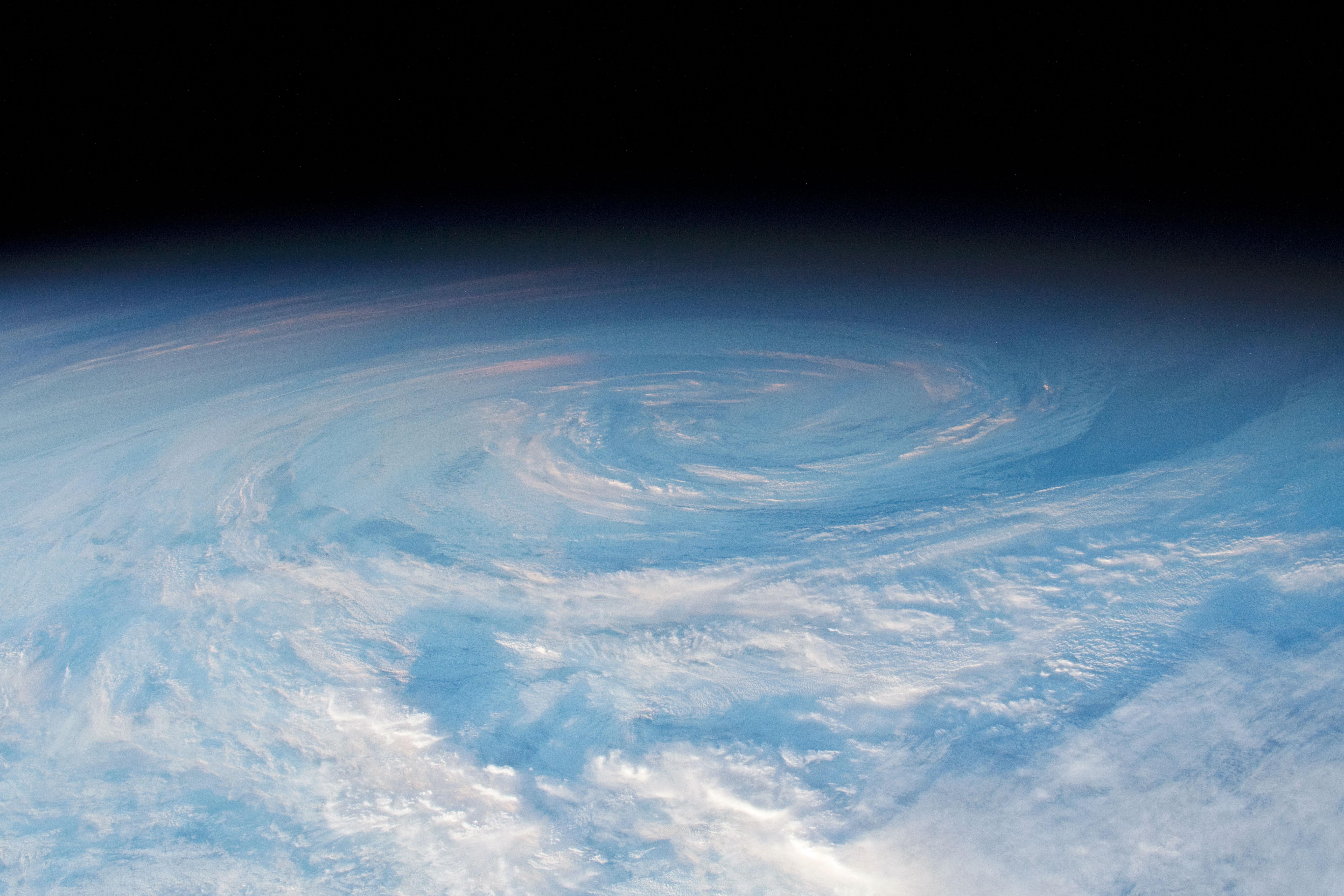
ニュージーランドから3,200km東、南アメリカから4,400km西の辺りに発生した低気圧の中心は、ちょうど夜明けのタイミングで撮影されました。ちなみに、このサイクロンは短時間で消滅したため、特段名前は付けられなかったようです。
参考文献: South Pacific Swirl (NASA Earth Observatory)
地球俯瞰画像を見る: LiVEARTH
[Earthview Wonders] No.855: South Pacific Swirl
Astronaut on board ISS captured this circular cloud formation at sunrise while orbiting over the South Pacific Ocean, 3,200km east of New Zealand and 4,400km west of South America.
This photo was taken close to the day-night line (“terminator”). The sunlight cast shadows made the sense of circular motion more distinct to the eye. This specific cloud formation had been a named tropical cyclone, but as the weather system was short-lived, the storm dissipated before making landfall, and thus was not named.
The local scenery on the ground is as follows.
Reference: South Pacific Swirl (NASA Earth Observatory)
See earthview photo gallery: LiVEARTH[:en][Earthview Wonders] No.855: South Pacific Swirl
Astronaut on board ISS captured this circular cloud formation at sunrise while orbiting over the South Pacific Ocean, 3,200km east of New Zealand and 4,400km west of South America.
This photo was taken close to the day-night line (“terminator”). The sunlight cast shadows made the sense of circular motion more distinct to the eye. This specific cloud formation had been a named tropical cyclone, but as the weather system was short-lived, the storm dissipated before making landfall, and thus was not named.
The local scenery on the ground is as follows.
Reference: South Pacific Swirl (NASA Earth Observatory)
See earthview photo gallery: LiVEARTH[:]