[:ja]NASAの地球観測衛星Terraが撮影したイランのウルミア湖(オルーミーイェ湖)です。
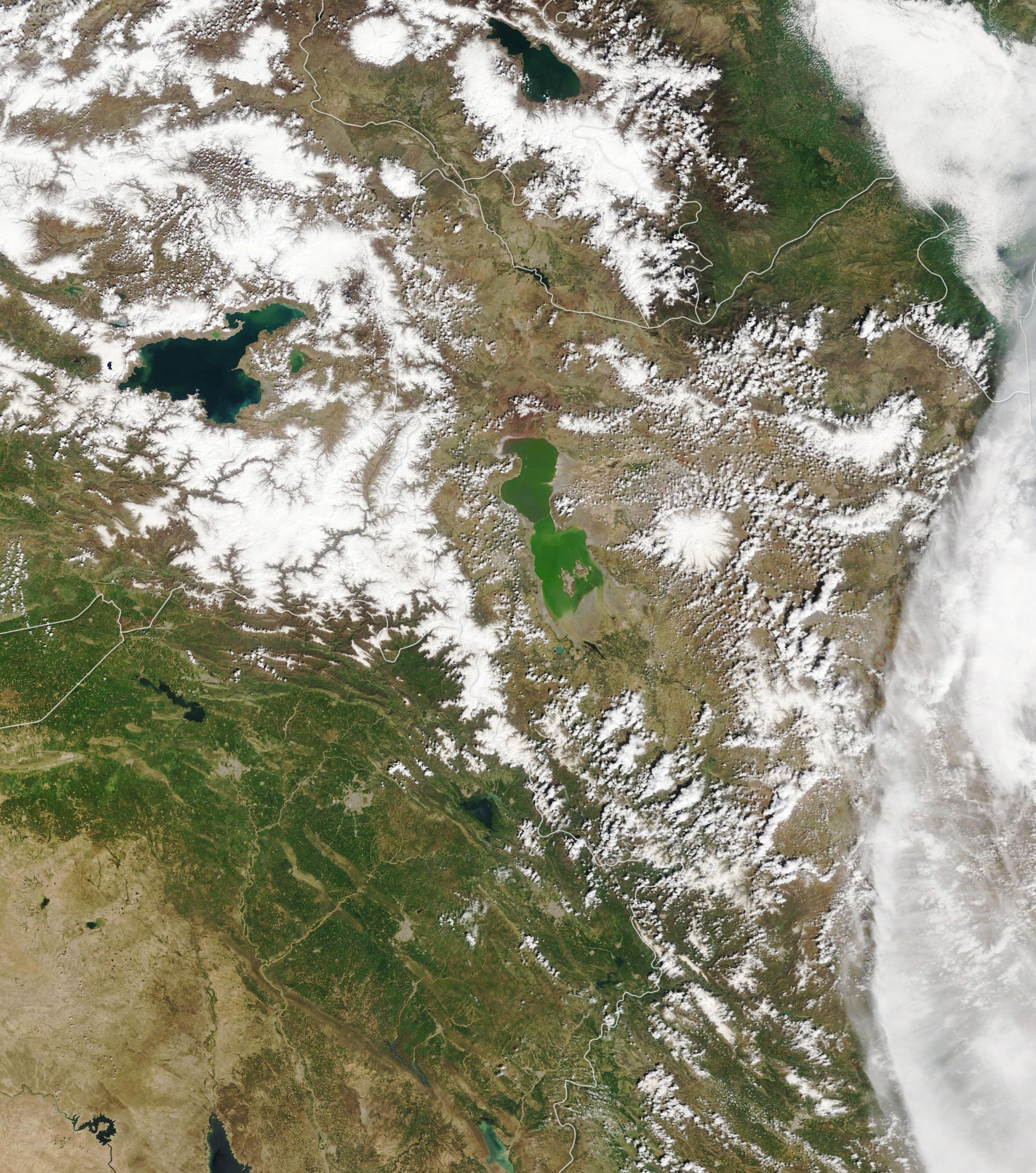
ウルミア湖はイランの北西にある塩湖で、イラン最大の湖です。最も深いところは深さ16mで、湖の中にはいくつかの島があり、渡り鳥の休憩地となっています。流入する河川でのダム整備の影響で20年前から水位の低下が目立ち、現在では湖の半分が干上がって湖底が露出。乾燥して塩分が堆積し、周辺農地の塩害や大気汚染による健康被害が懸念される事態となっています。2019年には水位が増加しています。
地上の様子はこちらです。

参考文献: Reviving the Shriveled Lake Urmia (NASA Earth Observatory)
地球俯瞰画像を見る: LiVEARTH
[Earthview Wonders] No.995: Lake Urmia🇮🇷
NASA’s Terra satellite captured Lake Urmia, Iran.
Lake Urmia is an endorheic salt lake in Iran, west of the southern portion of the Caspian Sea. At its greatest extent, it was the largest lake in the Middle East and the sixth-largest saltwater lake on Earth. By late 2017, the lake had shrunk to 10% of its former size (and 1/60 of water volume in 1998) due to persistent general drought in Iran, but also the damming of the local rivers that flow into it, and the pumping of groundwater from the surrounding area. This dry spell was broken in 2019 and the lake is now filling up once again.
Lake Urmia, along with its approximately 102 islands, is protected as a national park by the Iranian Department of Environment.
The local scenery on the ground is as follows.
Reference: Reviving the Shriveled Lake Urmia (NASA Earth Observatory)
See earthview photo gallery: LiVEARTH[:en][Earthview Wonders] No.995: Lake Urmia🇮🇷
NASA’s Terra satellite captured Lake Urmia, Iran.
Lake Urmia is an endorheic salt lake in Iran, west of the southern portion of the Caspian Sea. At its greatest extent, it was the largest lake in the Middle East and the sixth-largest saltwater lake on Earth. By late 2017, the lake had shrunk to 10% of its former size (and 1/60 of water volume in 1998) due to persistent general drought in Iran, but also the damming of the local rivers that flow into it, and the pumping of groundwater from the surrounding area. This dry spell was broken in 2019 and the lake is now filling up once again.
Lake Urmia, along with its approximately 102 islands, is protected as a national park by the Iranian Department of Environment.
The local scenery on the ground is as follows.
Reference: Reviving the Shriveled Lake Urmia (NASA Earth Observatory)
See earthview photo gallery: LiVEARTH[:]