[:ja]アン・マクレーン宇宙飛行士がISSから撮影したチリとアルゼンチンにまたがるマゼラン海峡です。
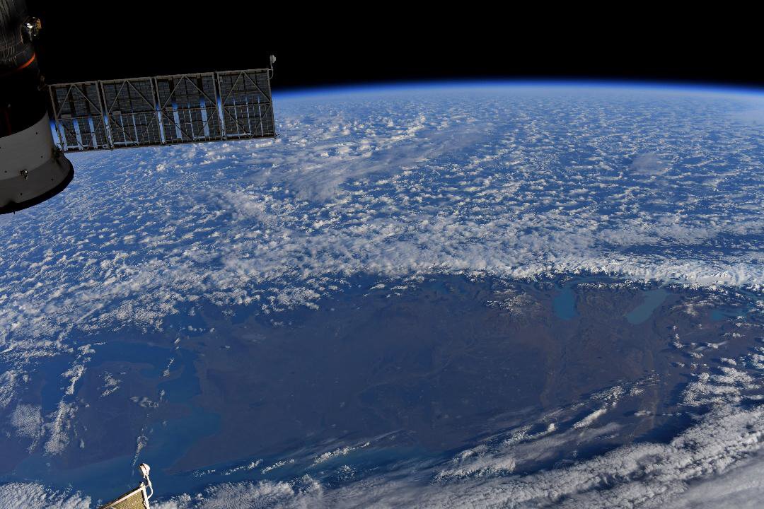
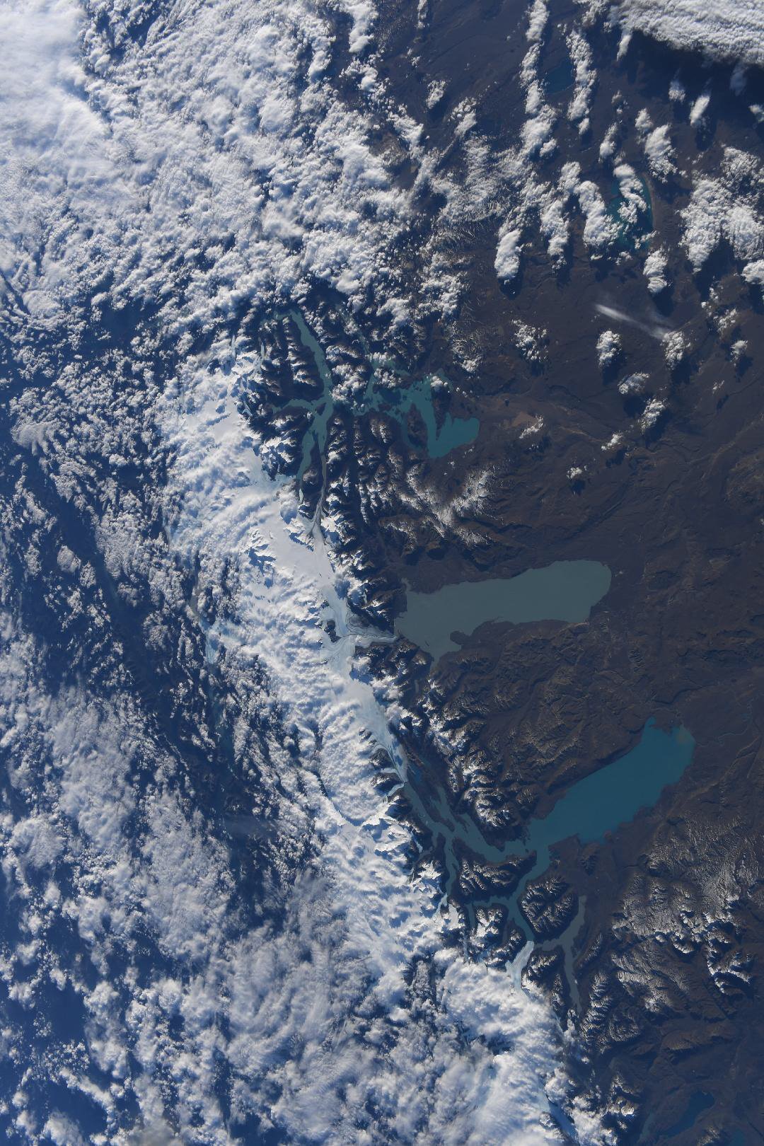
マゼラン海峡/マガリャネス海峡は、南アメリカ大陸南端とフエゴ島とを隔てる全長550km、幅3~30kmの海峡で、太平洋と大西洋を結びます。1520年10~11月にかけて、フェルディナンド・マゼランがここを通過し、後に彼の名前を採って「マゼラン海峡」と呼ばれるようになりました。1881年に締結されたチリ・アルゼンチン間の国境画定条約において、マゼラン海峡は自由通行が可能な海域とされ、個別条約に基づく国際海峡と認識されています。
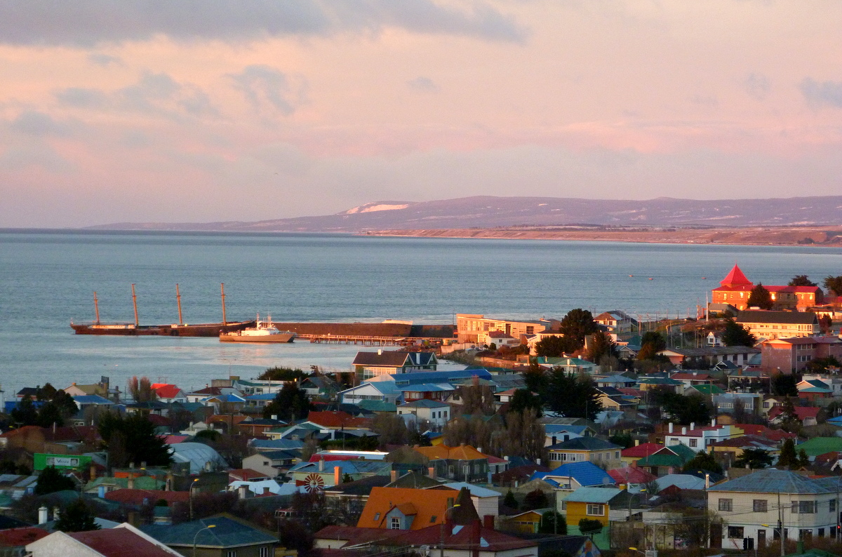
地上の様子はこちらです。
参考文献: Anne McClain’s Tweet
地球俯瞰画像を見る: LiVEARTH
[Earthview Wonders] No.1021: Strait of Magellan🇨🇱🇦🇷
Astronaut Anne McClain captured from ISS the Strait of Magellan that belongs to both Chile and Argentina.
The Strait of Magellan is a navigable sea route in southern Chile separating mainland South America to the north and Tierra del Fuego to the south. The strait is considered the most important natural passage between the Atlantic and Pacific oceans. It has been traversed by explorers and others throughout modern history, the first of which was achieved by Ferdinand Magellan in 1520. The route is difficult to navigate due to frequent narrows and unpredictable winds and currents.
The local scenery on the ground is as follows.
Reference: Anne McClain’s Tweet
See earthview photo gallery: LiVEARTH[:en][Earthview Wonders] No.1021: Strait of Magellan🇨🇱🇦🇷
Astronaut Anne McClain captured from ISS the Strait of Magellan that belongs to both Chile and Argentina.
The Strait of Magellan is a navigable sea route in southern Chile separating mainland South America to the north and Tierra del Fuego to the south. The strait is considered the most important natural passage between the Atlantic and Pacific oceans. It has been traversed by explorers and others throughout modern history, the first of which was achieved by Ferdinand Magellan in 1520. The route is difficult to navigate due to frequent narrows and unpredictable winds and currents.
The local scenery on the ground is as follows.
Reference: Anne McClain’s Tweet
See earthview photo gallery: LiVEARTH[:]