[:ja]ジェシカ・メイヤー宇宙飛行士がISSから撮影した夜の朝鮮半島の38度線です(:47~:50付近です)。宇宙から国境は見えないと言われますが、経済活動に比例した町の光量により国境が浮かび上がるのは興味深いです。
The brilliant green & orange lights of squid boats light up the seas across Asia, reminding me that without the incredible diversity of color on our planet, in its natural and man made beauty and reflected in the faces of its inhabitants, our world would be lacking on all fronts. pic.twitter.com/0qU8cedKhg
— Jessica Meir (@Astro_Jessica) June 5, 2020
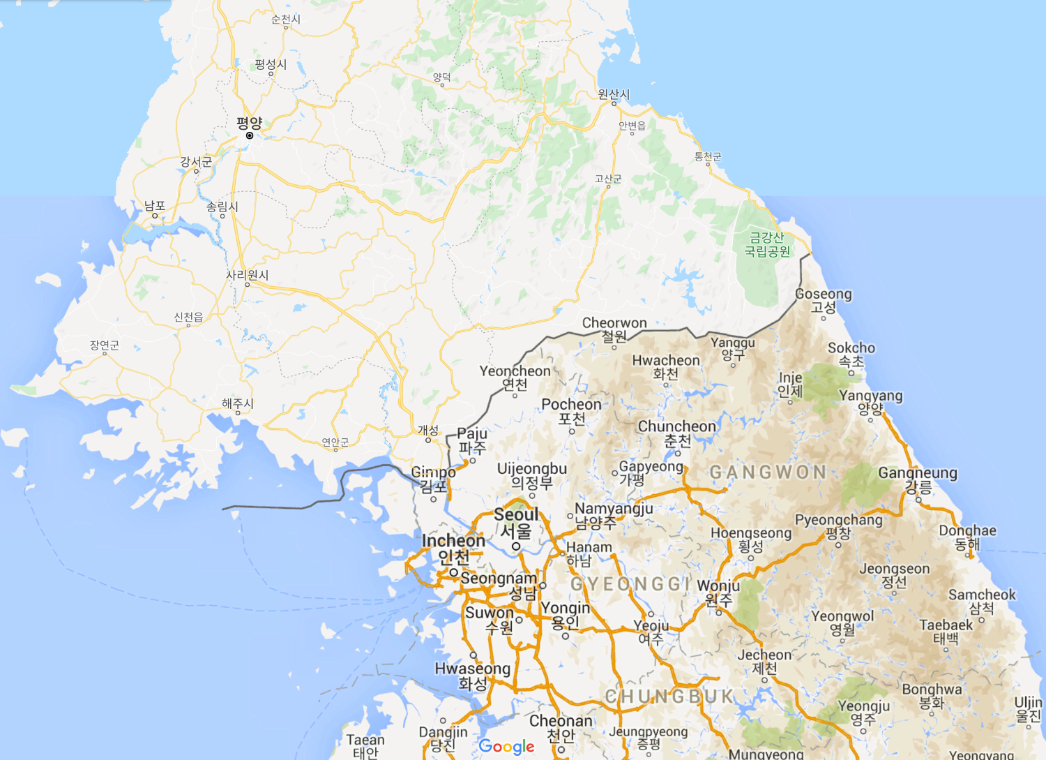
38度線は、第二次世界大戦末期に朝鮮半島を横切る北緯38度線に引かれたアメリカ軍とソ連軍の分割占領ラインで、北緯38度線上に定められたことから、こう呼ばれます。1950年6月25日に朝鮮戦争が勃発し、1953年に国連軍と朝鮮人民軍及び中国人民志願軍の間で休戦協定が結ばれました。この際、休戦協定直前の最前線が停戦ラインとされ、停戦ラインから南北2kmずつを非武装地帯(DMZ, Demilitarized zone)と呼ばれる緩衝地帯として設置し、朝鮮半島を横切る無人の地域となっています。また南北双方は侵入を防ぐ目的で、非武装地帯を何重にも鉄条網や高圧電線で囲い、幅4kmの帯状のこの地域に多くの地雷を敷設しています。以後アメリカ軍とソ連軍が引いた境界線に代わり、この停戦ラインが軍事境界線として、2020年現在も南北の事実上の境界線(国境)となっています。
地上の様子はこちらです。

参考文献: Jessica Meir’s Tweet
地球俯瞰画像を見る: LiVEARTH
[Earthview Wonders] No.1046: 38th Parallel of Korean Peninsula🇰🇵🇰🇷
Astronaut Jessica Meir captured from ISS 38th Parallel of Korean Peninsula (a:47~:50). It is said that country borders cannot be seen from space but it is interesting to note the border eventually emerge by the difference of city lights reflecting economic activities.
The brilliant green & orange lights of squid boats light up the seas across Asia, reminding me that without the incredible diversity of color on our planet, in its natural and man made beauty and reflected in the faces of its inhabitants, our world would be lacking on all fronts. pic.twitter.com/0qU8cedKhg
— Jessica Meir (@Astro_Jessica) June 5, 2020
In August 1945 when the World War II ended, the 38th parallel was established as the boundary between Soviet and American occupation zones. In 1948, this parallel became the boundary between the Democratic People’s Republic of Korea (North Korea) and the Republic of Korea (South Korea), both of which claim to be the government of the whole of Korea. The Korean War started in 1950 and after the Armistice agreement was signed in 1953, a new line was established to separate North Korea and South Korea. This Military Demarcation Line is surrounded by a Demilitarized Zone and the demarcation line crosses the 38th parallel, from the southwest to the northeast.
The local scenery on the ground is as follows.
Reference: Jessica Meir’s Tweet
See earthview photo gallery: LiVEARTH[:en][Earthview Wonders] No.1046: 38th Parallel of Korean Peninsula🇰🇵🇰🇷
Astronaut Jessica Meir captured from ISS 38th Parallel of Korean Peninsula (a:47~:50). It is said that country borders cannot be seen from space but it is interesting to note the border eventually emerge by the difference of city lights reflecting economic activities.
The brilliant green & orange lights of squid boats light up the seas across Asia, reminding me that without the incredible diversity of color on our planet, in its natural and man made beauty and reflected in the faces of its inhabitants, our world would be lacking on all fronts. pic.twitter.com/0qU8cedKhg
— Jessica Meir (@Astro_Jessica) June 5, 2020
In August 1945 when the World War II ended, the 38th parallel was established as the boundary between Soviet and American occupation zones. In 1948, this parallel became the boundary between the Democratic People’s Republic of Korea (North Korea) and the Republic of Korea (South Korea), both of which claim to be the government of the whole of Korea. The Korean War started in 1950 and after the Armistice agreement was signed in 1953, a new line was established to separate North Korea and South Korea. This Military Demarcation Line is surrounded by a Demilitarized Zone and the demarcation line crosses the 38th parallel, from the southwest to the northeast.
The local scenery on the ground is as follows.
Reference: Jessica Meir’s Tweet
See earthview photo gallery: LiVEARTH[:]