[:ja]NASAの地球観測衛星Landsat 8が撮影した米ルイジアナ州を中心に上陸したハリケーンローラによって発生した洪水の様子です。
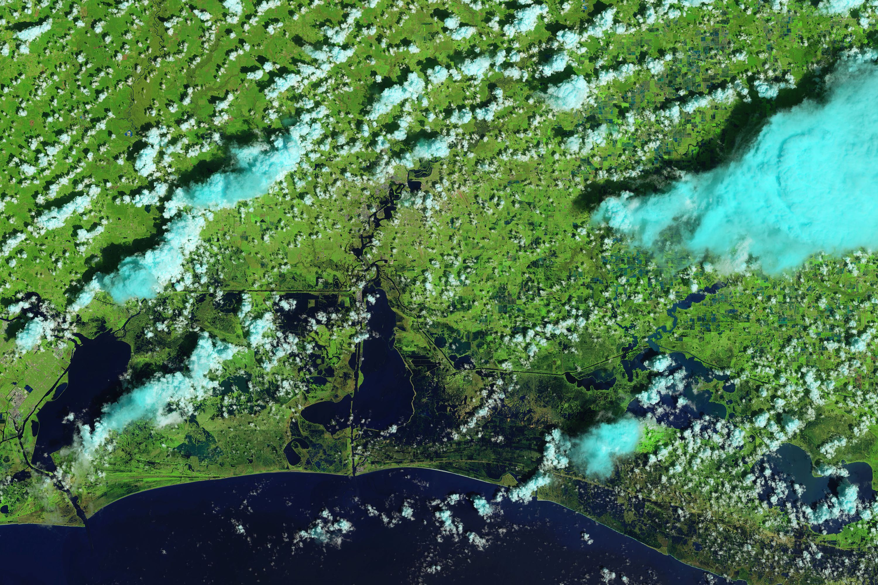
ハリケーン・ローラはカテゴリー4の強さ、時速240kmの強風雨とともに2020年8月26日にルイジアナ州に上陸しました。ルイジアナ州大西洋岸では、カルカシュー湖の周辺、レクチャールズ、キャメロン、クレオールといった町を中心に洪水の様子が確認され、停電で40万人が、止水で20万人が深刻な影響を受けています。コロラド州立大学の専門家によると、ハリケーンローラは米国に上陸したハリケーンとしては5番目の強さとされています。
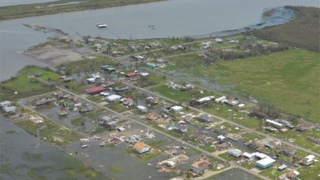
地上の様子はこちらです。
参考文献: Flooding, Blackouts in the Wake of Laura (NASA Earth Observatory)
地球俯瞰画像を見る: LiVEARTH
[Earthview Wonders] No.1106: Hurricane Laura🇺🇸
NASA’s Landsat 8 satellite captured the floods caused by Hurricane Laura over Louisiana, U.S.
On Aug. 26, 2020, Hurricane Laura made landfall as a category 4 storm with sustaining 240km/hr winds. Coastal lands around Lake Calcasieu such as Lake Charles, Cameron and Creole were seriously affected, and more than 400,000 were without power and 200,000 without water. According to hurricane historian Klotzbach of Colorado State University, Laura tied for the fifth strongest hurricane to ever make landfall in the U.S.
The local scenery on the ground is as follows.
Reference: Flooding, Blackouts in the Wake of Laura (NASA Earth Observatory)
See earthview photo gallery: LiVEARTH[:en][Earthview Wonders] No.1106: Hurricane Laura🇺🇸
NASA’s Landsat 8 satellite captured the floods caused by Hurricane Laura over Louisiana, U.S.
On Aug. 26, 2020, Hurricane Laura made landfall as a category 4 storm with sustaining 240km/hr winds. Coastal lands around Lake Calcasieu such as Lake Charles, Cameron and Creole were seriously affected, and more than 400,000 were without power and 200,000 without water. According to hurricane historian Klotzbach of Colorado State University, Laura tied for the fifth strongest hurricane to ever make landfall in the U.S.
The local scenery on the ground is as follows.
Reference: Flooding, Blackouts in the Wake of Laura (NASA Earth Observatory)
See earthview photo gallery: LiVEARTH[:]