[:ja]ルカ・パルミタノ宇宙飛行士がISSから撮影したジブラルタル海峡です。
ジブラルタル海峡は、ヨーロッパ大陸とアフリカ大陸を隔てる海峡です。地中海側の両岸の岩山は、古代より「ヘラクレスの柱」として知られてきました。海峡の幅は、イベリア半島最南端のタリファ岬からモロッコのアルカサル・エ・セリルまでが最も狭く14km、西端のトラファルガー岬〜スパルテル岬の間が最も広く45kmです。
地上の様子はこちらです。

参考文献: Luca Parmitano’s Tweet
地球俯瞰画像を見る: LiVEARTH
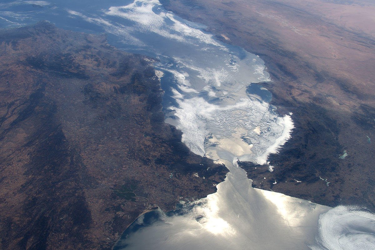
[Earthview Wonders] No.1118: Strait of Gibraltar
Astronaut Luca Parmitano captured from ISS the Strait of Gibraltar.
The strait connects the Atlantic Ocean to the Mediterranean Sea and separates Gibraltar and Peninsular Spain in Europe from Morocco and Ceuta (Spain) in Africa. It is also called the Pillars of Hercules. Europe and Africa are separated 14.3km of ocean at the strait’s narrowest point.
The local scenery on the ground is as follows.
Reference: Luca Parmitano’s Tweet
See earthview photo gallery: LiVEARTH[:en][Earthview Wonders] No.1118: Strait of Gibraltar
Astronaut Luca Parmitano captured from ISS the Strait of Gibraltar.
The strait connects the Atlantic Ocean to the Mediterranean Sea and separates Gibraltar and Peninsular Spain in Europe from Morocco and Ceuta (Spain) in Africa. It is also called the Pillars of Hercules. Europe and Africa are separated 14.3km of ocean at the strait’s narrowest point.
The local scenery on the ground is as follows.
Reference: Luca Parmitano’s Tweet
See earthview photo gallery: LiVEARTH[:]