[:ja]ルカ・パルミタノ宇宙飛行士がISSから撮影した米国のグレートプレーンズ南東部の高積雲です。
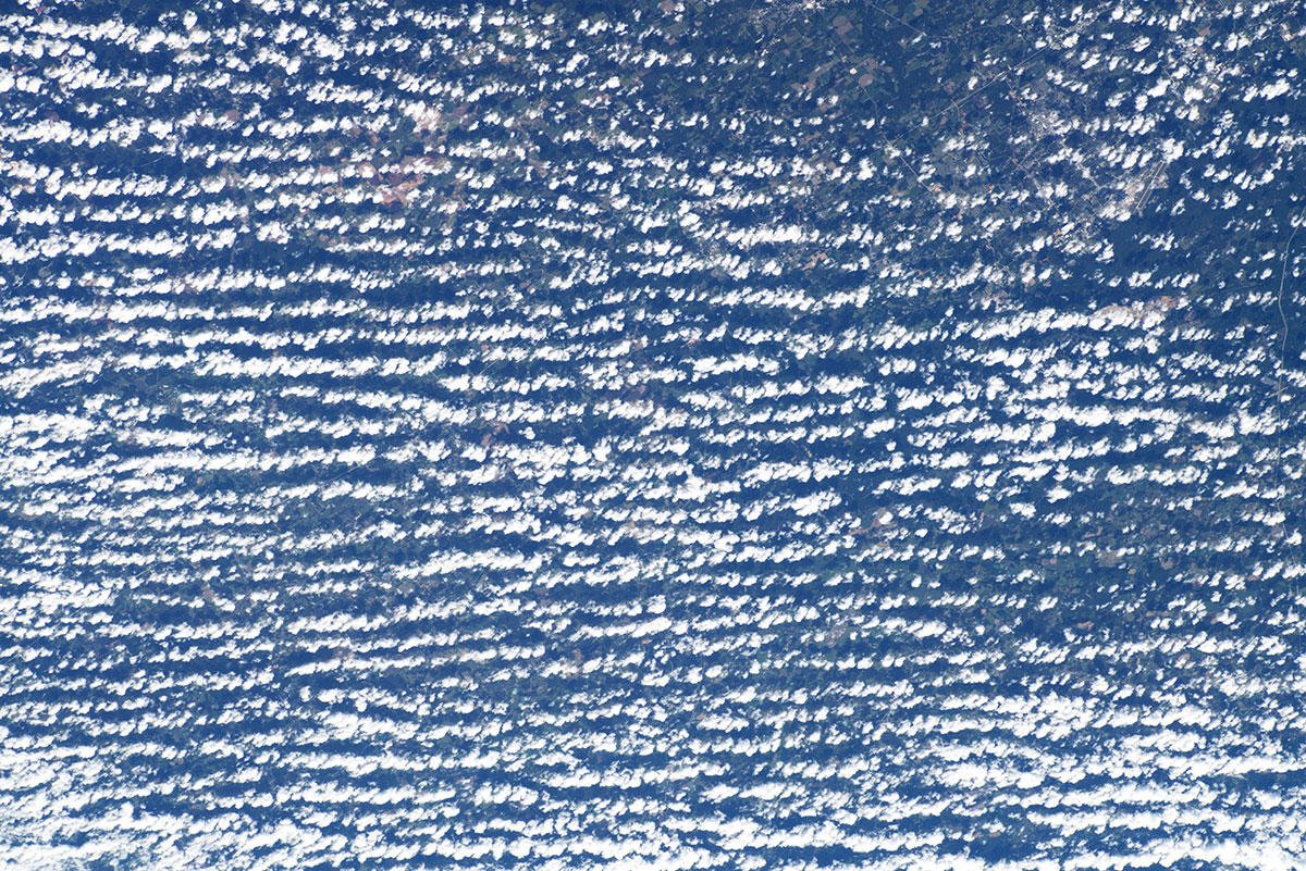
高積雲(こうせきうん)は、小さな塊状の雲片が群れをなして、斑状や帯状の形をつくり、白色で一部灰色の陰影をもつ雲で、まだら雲、ひつじ雲、叢雲(むら雲)とも言います。巻積雲よりも塊が大きく、はっきりとした白色をしており、下部が灰色になります。高度2-7km程度に大抵氷の結晶として形成され、これは高度5-15kmの上空高く浮かぶ巻積雲と区別されます。寒気団の内部の気流の影響や、寒気団上部に暖気が接した際にできることが多く、小規模な大気波の影響で帯状・波紋状に発達して広がっていきます。
地上の様子はこちらです。

参考文献: Luca Parmitano’s Tweet
地球俯瞰画像を見る: LiVEARTH
[Earthview Wonders] No.1158: Altocumulus Clouds🇺🇸
Astronaut Luca Parmitano captured from ISS the Altocumulus Clouds in the Great Plains of southeastern U.S.
Altocumulus is a middle-altitude cloud genus that belongs mainly to the stratocumuliform physical category characterized by globular masses or rolls in layers or patches, the individual elements being larger and darker than those of cirrocumulus and smaller than those of stratocumulus. Altocumulus is commonly found between the warm and cold fronts in a depression, although this is often hidden by lower clouds. Towering altocumulus, known as altocumulus castellanus, frequently signals the development of thunderstorms later in the day, as it shows instability and convection in the middle levels of the troposphere.
The local scenery on the ground is as follows.
Reference: Luca Parmitano’s Tweet
See earthview photo gallery: LiVEARTH[:en][Earthview Wonders] No.1158: Altocumulus Clouds🇺🇸
Astronaut Luca Parmitano captured from ISS the Altocumulus Clouds in the Great Plains of southeastern U.S.
Altocumulus is a middle-altitude cloud genus that belongs mainly to the stratocumuliform physical category characterized by globular masses or rolls in layers or patches, the individual elements being larger and darker than those of cirrocumulus and smaller than those of stratocumulus. Altocumulus is commonly found between the warm and cold fronts in a depression, although this is often hidden by lower clouds. Towering altocumulus, known as altocumulus castellanus, frequently signals the development of thunderstorms later in the day, as it shows instability and convection in the middle levels of the troposphere.
The local scenery on the ground is as follows.
Reference: Luca Parmitano’s Tweet
See earthview photo gallery: LiVEARTH[:]