[:ja]NASAの地球観測衛星Landsat 8が撮影したインドネシアの首都で同国最大の都市ジャカルタです。
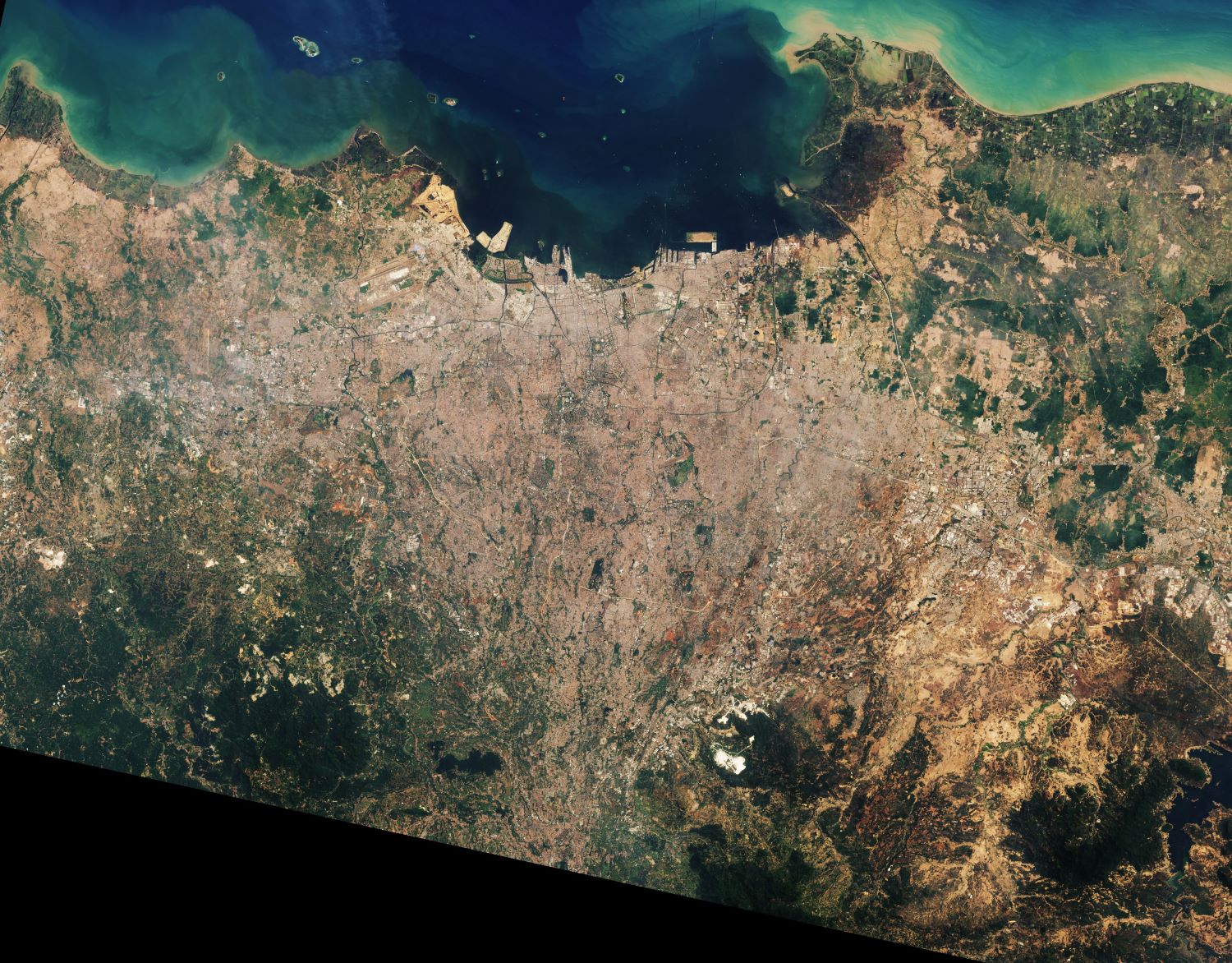
人口は約1千万人、近郊を含む都市圏人口は3,120万人と、東京都市圏に次いで世界第2位のメガシティであり、東南アジア有数の世界都市でもあります。東南アジア諸国連合(ASEAN)の事務局が置かれています。ジャカルタは熱帯モンスーン気候 (Am) に属し、高温多湿です。気温は一年中ほとんど変わりませんが、赤道に比較的近いにもかかわらず明確な雨季と乾季があります。7月から10月にかけての4ヶ月は乾季であり、11月から6月までの8ヶ月は雨季にあたります。画像からもわかるように、ジャカルタの北部の海抜は低く、南部は丘陵地となっており、河川は南部から北部へと流れます。最も重要な河川はチリウン川で、ジャカルタ市域のほぼ中央を流れています。これらの河川は、ジャカルタの低い地形、潮の干満、そして雨季の降水量によってしばしば氾濫を起こしますが、低地の被害は拡大傾向にあります。近年は地盤沈下が進行しており、ジャカルタは毎年5~10cmずつ沈んでいると言われています。
地上の様子はこちらです。

参考文献: As Jakarta Grows, So Do the Water Issues (NASA Earth Observatory)
地球俯瞰画像を見る: LiVEARTH
[Earthview Wonders] No.1290: Jakarta🇮🇩
NASA’s Landsat 8 satellite captured Jakarta, the capital and the largest city of Indonesia.
Jakarta, which lies on the northwest coast of Java (the world’s most populous island), is the center of the economy, culture and politics of Indonesia. Jakarta with about 36 million metropolitan population is the world’s second-most populous urban area, after Tokyo. Jakarta’s primary challenges include rapid urban growth, ecological breakdown, gridlocked traffic, congestion, and flooding. Jakarta is sinking up to 17cm per year, which, coupled with the rising of sea levels, has made the city more prone to flooding. It is one of the fastest-sinking capitals in the world.
The local scenery on the ground is as follows.
Reference: As Jakarta Grows, So Do the Water Issues (NASA Earth Observatory)
See earthview photo gallery: LiVEARTH[:]