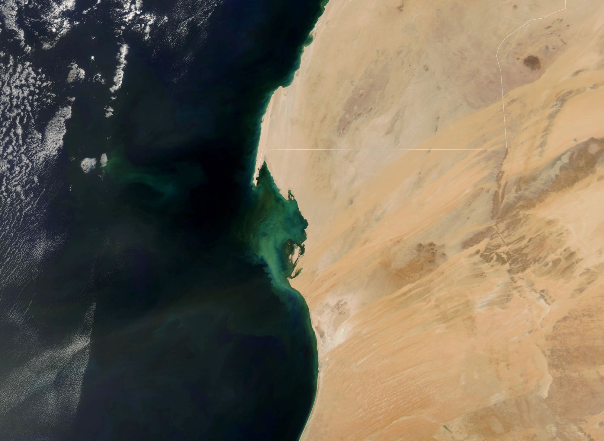
[:ja]NASAの地球観測衛星Aquaが撮影したモーリタニアの大西洋岸と、植物プランクトンが繁茂している様子です。首都ヌアクショットも見えています。
アフリカ大陸の西側に位置するモーリタニアは、全土がサハラ砂漠に位置するため国土の90%以上が砂漠であり、中央部にリシャット構造と呼ばれる同心円状の特徴的な地形があります。南部のセネガル国境を成すセネガル川流域や点在するオアシスが僅かに乾燥を免れた地域となっています。大西洋岸とセネガル川流域には平野が広がり、内陸部は高原となっています。モーリタニアの主産業は鉱業であり、なかでも北部のズエラットで採掘される鉄鉱石が経済の柱となっています。2014年度には鉄鉱石輸出は輸出の39.9%を占めて最大輸出品となっており、このほか、金が輸出の15.1%、銅が輸出の10.1%を占めるなど、鉱業がモーリタニア経済に占める割合は大きいです。鉱業と並ぶモーリタニア経済のもう一つの柱が水産業です。2014年度には魚介類輸出が輸出の14.7%、これと別枠でイカ・タコ類が10.6%を占め、おおよそ輸出の4分の1が水産物で占められています。
地上の様子はこちらです。


参考文献: Perma-Blooms off Mauritania (NASA Earth Observatory)
地球俯瞰画像を見る: LiVEARTH
[Earthview Wonders] No.1314: Mauritania🇲🇷
NASA’s Aqua satellite captured the Atlantic coast of Mauritania and the spread of phytoplankton. Nouakchott, the capital city is also captured in the image.
Mauritania’s name derives from the name of the ancient Berber kingdom of Mauretania, located in present-day Morocco and Algeria. In the late 19th century, during European Scramble for Africa, Mauritania became a French colony. Mauritania became independent from French West Africa in 1960. Since then, it has experienced recurrent coups and periods of authoritarian military rule. Approximately 90% of Mauritania’s land is in the Sahara. As a result, most of its inhabitants live in the south of the country, where precipitation is slightly higher. Mauritania has extensive deposits of iron ore, which account for almost 50% of total exports. Gold and copper mining companies are opening mines in the interior.
The local scenery on the ground is as follows.
Reference: Perma-Blooms off Mauritania (NASA Earth Observatory)
See earthview photo gallery: LiVEARTH[:]