[:ja]トマ・ペスケ宇宙飛行士がISSから撮影したタンザニアのインド洋岸です。
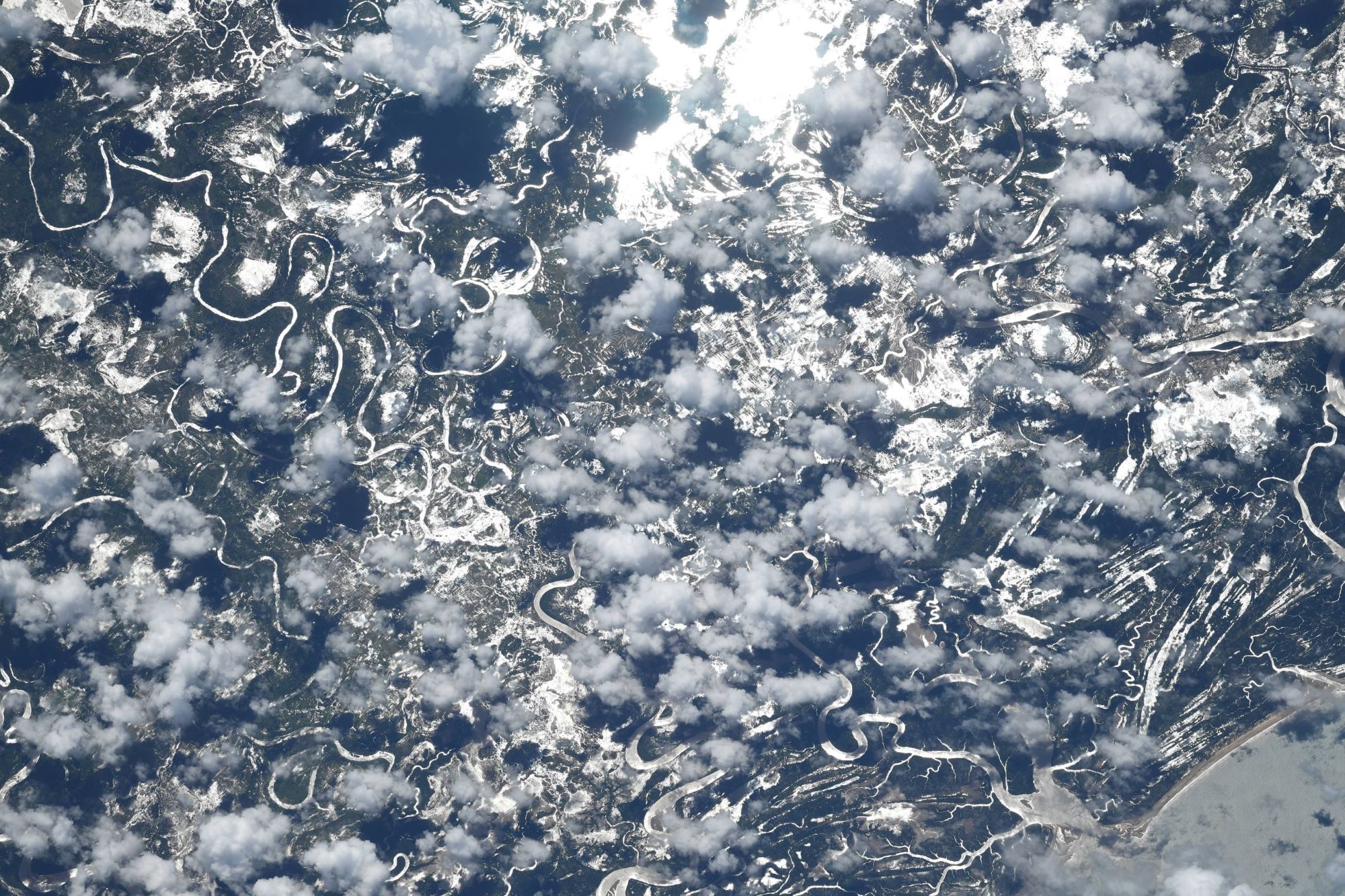
タンザニアの地形は多様です。北東部にアフリカ最高峰のキリマンジャロ山(5,895m)があり、北部にアフリカ最大の面積を誇るビクトリア湖、西部にアフリカで最も深いタンガニーカ湖があります。この南のニアサ湖を含めアフリカ三大湖が存在し、これらはアフリカ大地溝帯が形成したものです。中部には高原が広がる。東部海岸は蒸し暑い気候で、ザンジバル島(ウングジャ島)がすぐ沖合にあります。そして、この画像にもあるように、海岸部に熱帯半落葉降雨林が広がっています。
ルフィジ・デルタの地上の様子はこちらです。

参考文献: Thomas Pesquet’s Tweet
地球俯瞰画像を見る: LiVEARTH
[Earthview Wonders] No.1356: Tanzania🇹🇿
Astronaut Thomas Pesquet captured from ISS the Indian coast of Tanzania.
Tanzania has a variety of geographical features. The country is mountainous and densely forested in the northeast, where Mount Kilimanjaro is located. Three of Africa’s Great Lakes are partly within Tanzania. To the north and west lie Lake Victoria, Africa’s largest lake, and Lake Tanganyika, the continent’s deepest lake, known for its unique species of fish. To the southwest lies Lake Nyasa. Central Tanzania is a large plateau, with plains and arable land. As shown in this image, the eastern shore is hot and humid, with the Zanzibar Archipelago just offshore.
The local scenery on the ground of Rufiji Delta is as follows.
Reference: Thomas Pesquet’s Tweet
See earthview photo gallery: LiVEARTH[:]