[:ja]トマ・ペスケ宇宙飛行士がISSから撮影したフランス、スペイン、アンドラの国境付近のピレネー山脈です。
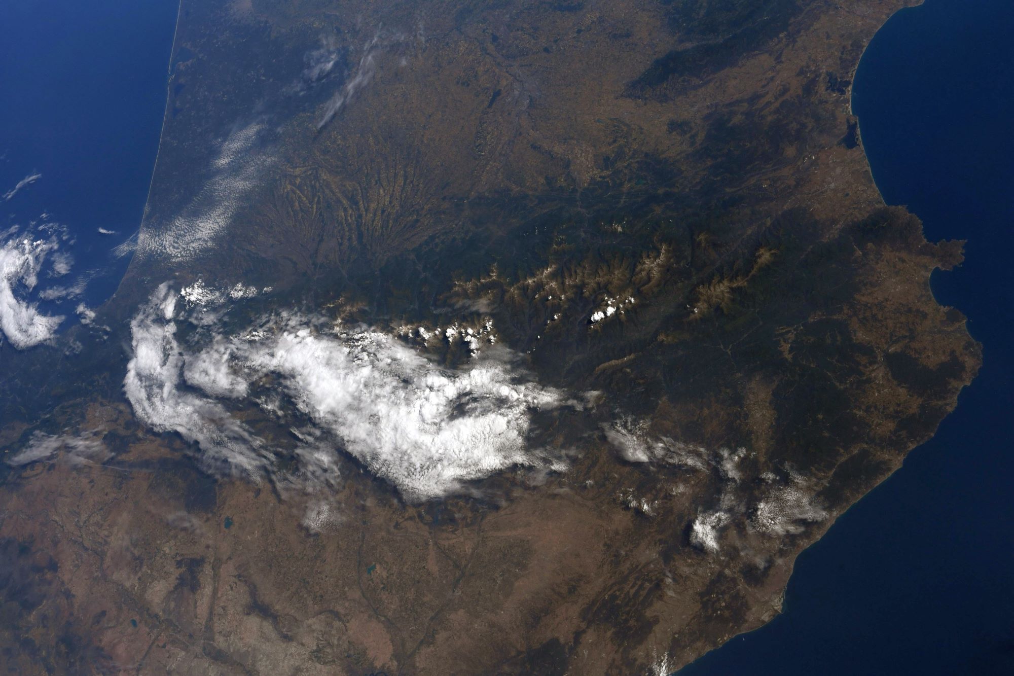
ピレネー山脈は、イベリア半島の付け根付近をほぼ東西方向に走る、長さ約430kmの褶曲山脈です。ピレネー山脈は、地質学的にはアルプス山脈よりも古い時代の地層からできています。現在のピレネー山脈の山体を構成する主な岩石は花崗岩であるものの、山脈の西部の周辺部には石灰岩なども見られます。ピレネー西部は1000m級のなだらかな山地であるのに対して、中央部から東部は2000~3000m級の山が多いです。
地上の様子はこちらです。

参考文献: Thomas Pesquet’s Tweet
地球俯瞰画像を見る: LiVEARTH
[Earthview Wonders] No.1358: Pyrenees🇫🇷🇪🇸🇦🇩
Astronaut Thomas Pesquet captured from ISS the Pyrenees which functions as the border of France, Spain and Andorra.
The Pyrenees is a range of mountains in southwest Europe that forms a natural border between Spain and France. Reaching a height of 3,404m at the peak of Aneto, the range separates the Iberian Peninsula from the rest of continental Europe, and extends for about 491km from the Bay of Biscay to the Mediterranean Sea. The Pyrenees are older than the Alps: their sediments were first deposited in coastal basins during the Paleozoic and Mesozoic eras.
The local scenery on the ground is as follows.
Reference: Thomas Pesquet’s Tweet
See earthview photo gallery: LiVEARTH[:]