[:ja]イワン・ワグナー宇宙飛行士がISSから撮影したオーストラリアの巨岩カタジュタです。
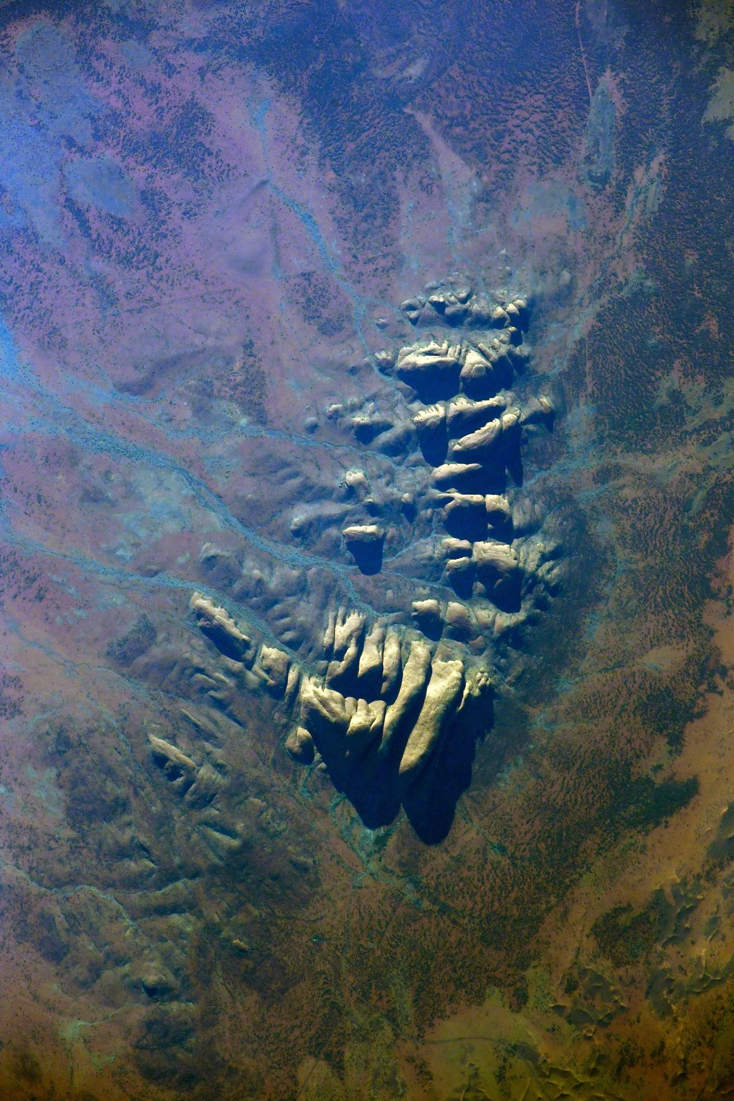
カタ・ジュタは、一般にオルガ山(Mount Olga)と呼ばれるノーザンテリトリーのアリススプリングス南西365kmに位置し約22平方kmに広がるいくつもの岩山(礫岩)で、高さは海抜1066m、地表から546mです。カタ・ジュタとはアボリジニの言葉で「多くの頭」という意味で、ユネスコの世界遺産(複合遺産)に登録されています。アボリジニの聖地の1つで、特に夜間に多くの儀式が行われる。この儀式は、過去には罰を与える場であり、時には死に至るほどの重い罰が与えられることもあったと伝えられています。カタ・ジュタは近隣のウルル(エアーズロック)などとともに頻繁にアボリジニの神話に登場する場所で、この山の頂上にはワナンビと呼ばれる蛇が住んでいて、乾期にのみ下山するといわれています。
地上の様子はこちらです。

参考文献: Ivan Vagner’s Tweet
地球俯瞰画像を見る: LiVEARTH
[Earthview Wonders] No.1365: Kata Tjuta🇦🇺
Astronaut Ivan Vagner captured from ISS Kata Tjuta, Australia.
Kata Tjuṯa, also known as the Olgas, is a group of large, domed rock formations or bornhardts located about 360km southwest of Alice Springs, in the southern part of the Northern Territory, central Australia. Uluṟu, also known as Ayers Rock, located 25km to the east, and Kata Tjuṯa form the two major landmarks within the Uluṟu-Kata Tjuṯa National Park. The park is considered sacred to the Aboriginal people of Australia. The 36 domes that make up Kata Tjuṯa cover an area of 21.68km2, are composed of conglomerate, a sedimentary rock consisting of cobbles and boulders of varying rock types including granite and basalt, cemented by a matrix of sandstone. The highest dome, Mount Olga, is 1,066m above sea level.
The local scenery on the ground is as follows.
Reference: Ivan Vagner’s Tweet
See earthview photo gallery: LiVEARTH[:]