[:ja]トマ・ペスケ宇宙飛行士がISSから撮影した米サンディエゴとメキシコのティファナの米国=メキシコ国境です。
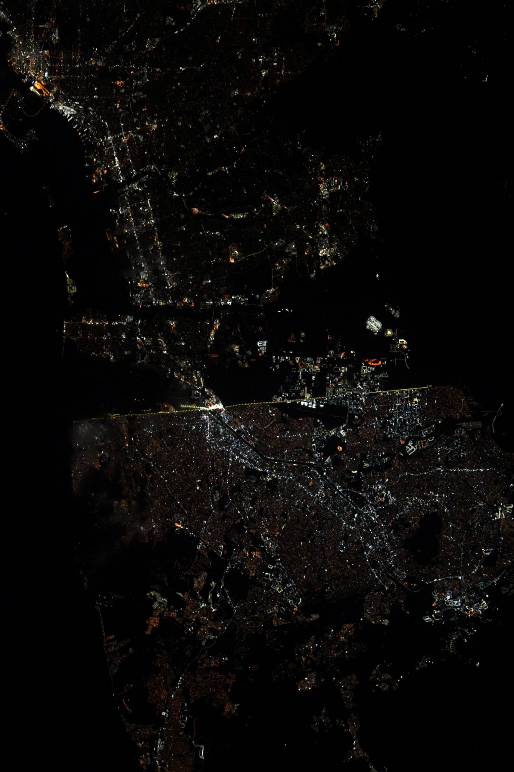
アメリカ=メキシコ国境は、4つのアメリカの州と6つのメキシコの州に接しています。20以上の横断道路があり、米サンディエゴとメキシコバハカリフォルニア州ティフアナの接する西から、米テキサス州ブラウンズビルとメキシコタマウリパス州マタモロスが接する東まで伸びています。都会のエリアから荒れ果てた砂漠までさまざまな地形を横切り、東はテキサス州エルパソとメキシコチワワ州シウダー・フアレスの両国の大都市圏の境界を成し、メキシコ湾に流れるリオグランデ川に沿っています。ソノラ砂漠、チワワ砂漠、コロラド川デルタ、バハカリフォルニア半島の北端も横切ります。境界の全長は3,141kmにもおよび、世界で最も頻繁に横断される国境で、毎年のべ3億5000万人が合法的に横断しています。
地上の様子はこちらです。

参考文献: Thomas Pesquet’s Tweet
地球俯瞰画像を見る: LiVEARTH
[Earthview Wonders] No.1374: U.S.-Mexico Border🇺🇸🇲🇽
Astronaut Thomas Pesquet captured from ISS the border of U.S. and Mexico at San Diego and Tijuana.
The Mexico–United States border is an international border separating Mexico and the U.S., extending from the Pacific Ocean in the west to the Gulf of Mexico in the east. The border traverses a variety of terrains, ranging from urban areas to deserts. The Mexico–US border is the most frequently crossed border in the world, with approximately 350 million documented crossings annually. The total length of the continental border is 3,145km. From the Gulf of Mexico, it follows the course of the Rio Grande to the border crossing at Ciudad Juarez, Chihuahua, and El Paso, Texas. Westward from El Paso–Juarez, it crosses vast tracts of the Chihuahuan and Sonoran deserts to the Colorado River Delta and San Diego–Tijuana, before reaching the Pacific Ocean. (Credit: Thomas Pesquet, ESA, NASA)
The local scenery on the ground is as follows.
Reference: ‘s Tweet
See earthview photo gallery: LiVEARTH[:]