[:ja]NASAの地球観測衛星Landsat 8が撮影したイランのホルムズ島です。
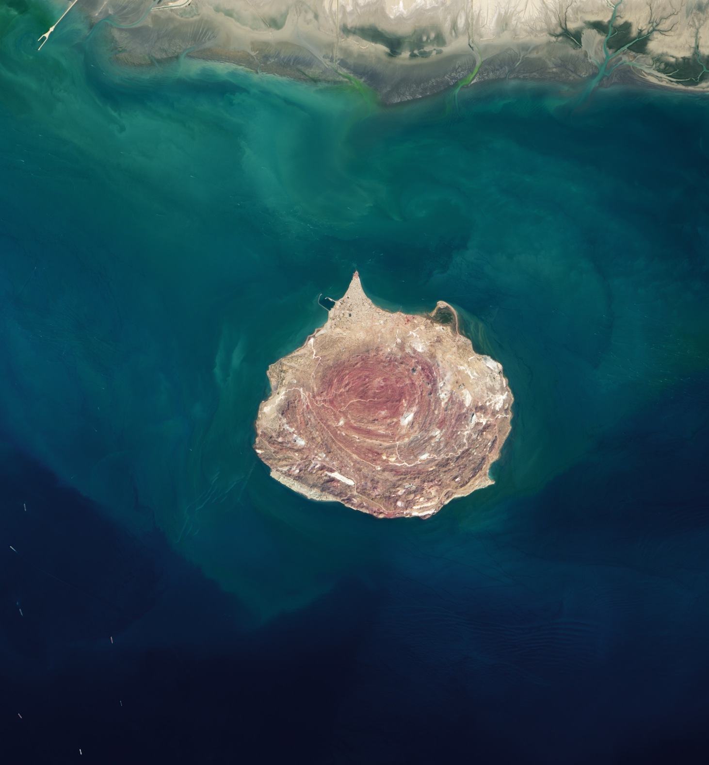
ホルムズ島は、ペルシア湾のホルムズ海峡にあるイランのホルモズガーン州に属する島で、面積は約42km2、最高地点は海抜186mです。ペルシア湾、インド洋の海上交易における要衝に位置しており、14世紀に60㎞離れた本土側の港町ホルムズ (現バンダレ・アッバース) から、当時Jarunと呼ばれたこの島に新ホルムズが建設されました。1515年、ポルトガルに占領されましたが、1622年、サファヴィー朝のアッバース1世の治世下において、イギリス東インド会社の援助を受けてホルムズ島は奪回されました。現在の島では約3000人ほどが生活しています。堆積岩と火山性の物質からなる地層で表土がおおわれています。また、降水が少ないため、土壌と河川水には塩分が混じり、新鮮な水を得るためにイラン本土から飲料水のパイプラインが引かれています。
地上の様子はこちらです。

参考文献: Iran’s Rainbow Island (NASA Earth Observatory)
地球俯瞰画像を見る: LiVEARTH
[Earthview Wonders] No.1414: Hormuz Island🇮🇷
NASA’s Landsat 8 satellite captured Hormuz Island, Iran.
Hormuz Island is an Iranian island in the Persian Gulf. Located in the Strait of Hormuz, 8km off the Iranian coast, the island is part of Hormozgan Province. The island has an area of 42km2 and the highest point of 186m. It is covered by sedimentary rock and layers of volcanic material on its surface. Due to a lack of precipitation, the soil and water are salty. Due to the lack of fresh water, Iranian engineers have constructed a water pipeline from the mainland. There are many virgin beaches that go all around the island.
The local scenery on the ground is as follows.
Reference: Iran’s Rainbow Island (NASA Earth Observatory)
See earthview photo gallery: LiVEARTH[:]