[:ja]野口聡一宇宙飛行士がISSから撮影したタヒチのタヒチ島とモーレア島です。
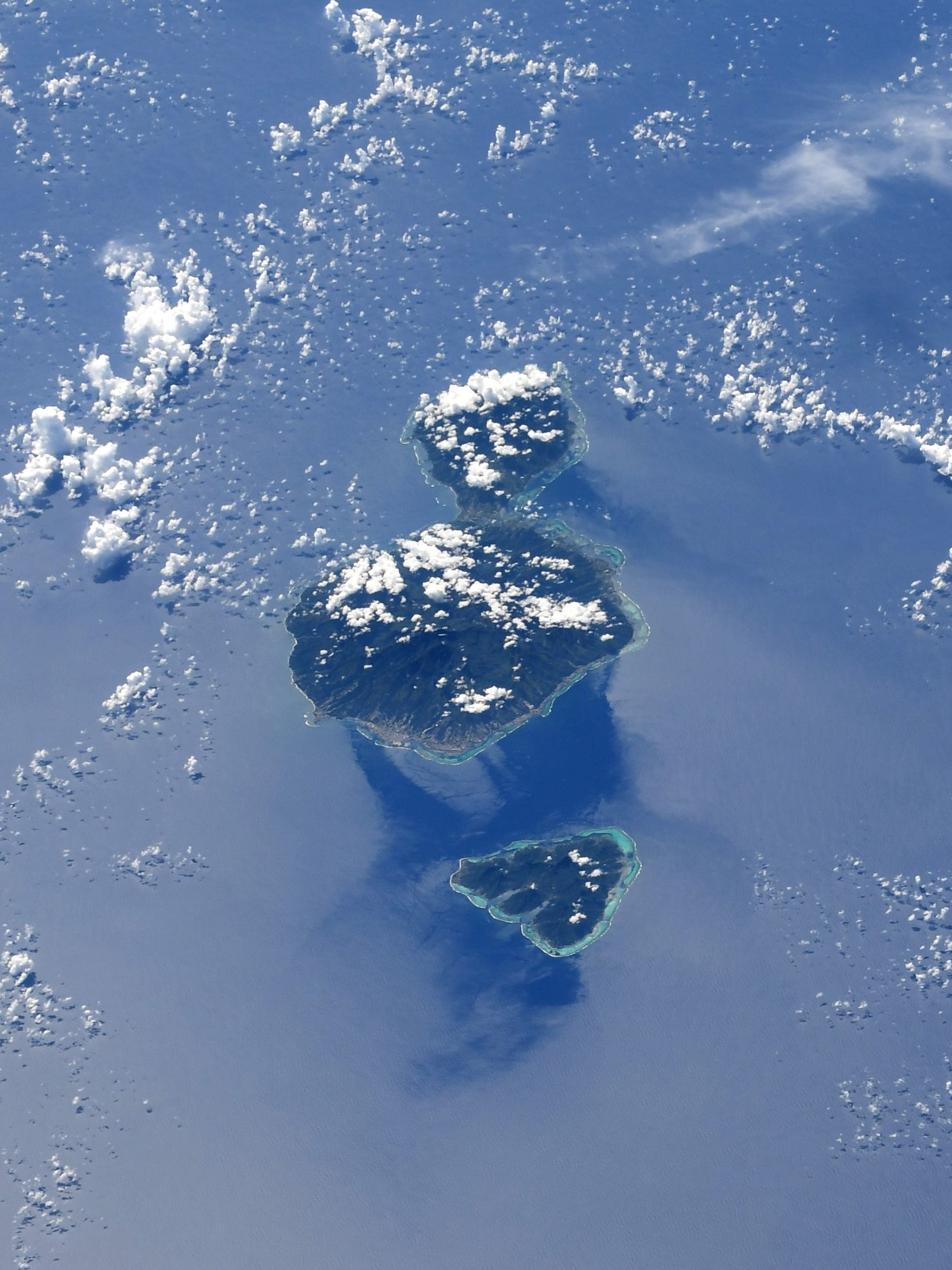
タヒチ島は、南太平洋フランス領ポリネシアに属するソシエテ諸島にある島で、首都はパペーテ、南太平洋有数のリゾート地として知られています。冒険家ヘイエルダールの逸話や、画家ゴーギャンが晩年移り住んだ島としても有名です。火山性の山がちな島で、最高峰は標高2,241mにも及ぶオロヘナ山です。島の周囲をサンゴ礁が取り巻き、火山性特有の黒い砂浜が多いのが特徴です。タヒチ島は大小の二つの島がタラバオ地峡でつながってヒョウタンのような形をしている島で、大きい方がタヒチ・ヌイ、小さい方がタヒチ・イティと呼ばれています。
地上の様子はこちらです。

参考文献: Soichi Noguchi’s Tweet
地球俯瞰画像を見る: LiVEARTH
[Earthview Wonders] No.1492: Tahiti🇵🇫
Astronaut Soichi Noguchi captured from ISS Tahiti and Moorea Island.
Tahiti is the largest island of the Windward group of the Society Islands in French Polynesia, located in the central part of the Pacific Ocean. Divided into two parts, Tahiti Nui (bigger, northwestern part) and Tahiti Iti (smaller, southeastern part), the island was formed from volcanic activity, andthose two roughly round portions centered on volcanic mountains are connected by a short isthmus named after the small town of Taravao. French is the only official language, although the Tahitian language (Reo Tahiti) is widely spoken.
The local scenery on the ground is as follows.
Reference: Soichi Noguchi’s Tweet
See earthview photo gallery: LiVEARTH[:]