[:ja]米国のUNCWの地球観測衛星SeaHawk-1が撮影したフランスのカレー海峡(英:ドーバー海峡)です。
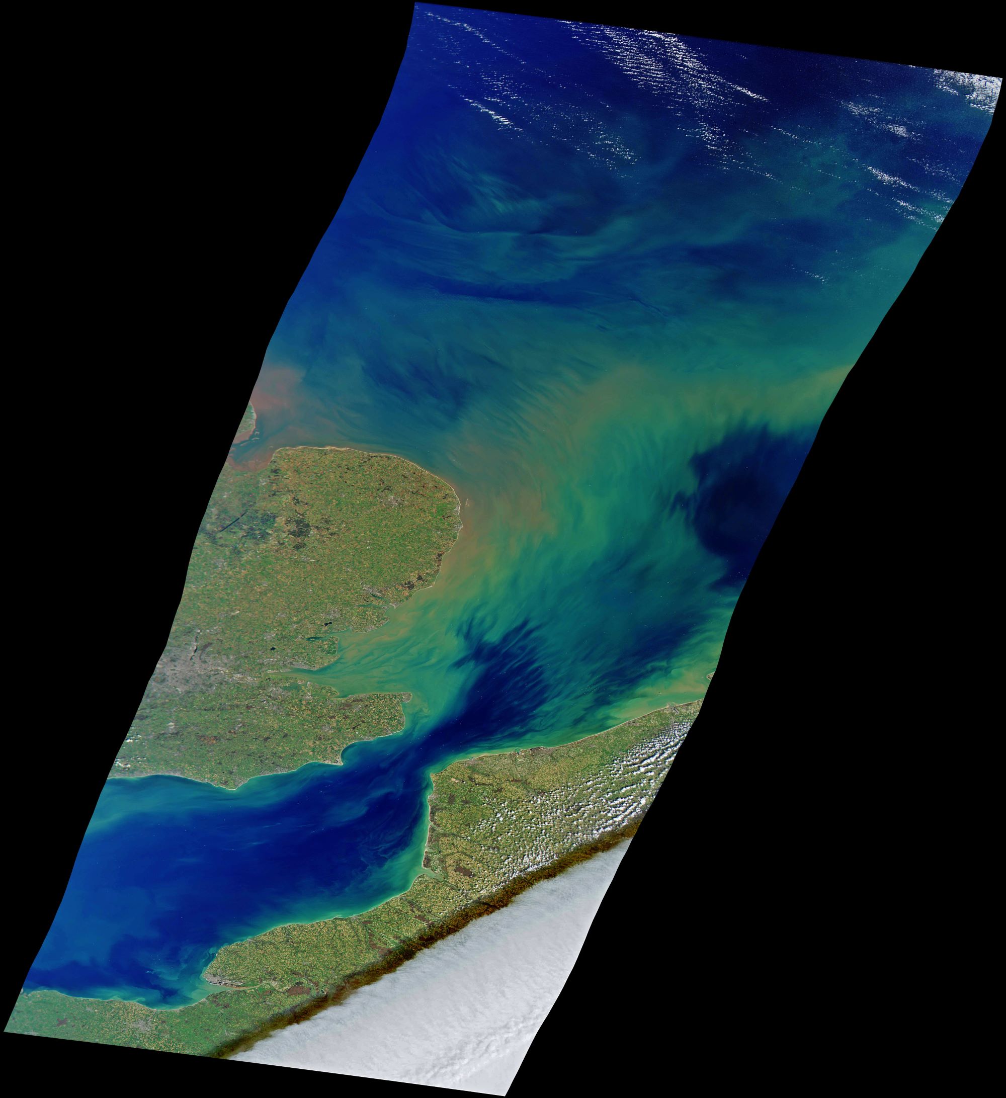
カレー海峡(ドーバー海峡)は、フランスとイギリスを隔てるイギリス海峡の最狭部で34km、英仏海峡トンネルが通っています。国際水路機関(IHO)による海域分類では、北東の北海と南西のイギリス海峡の境界付近にありますが、イギリス海峡を広義の大西洋の一部とし「大西洋と北海の境」ととらえることもあります。カレーは、前近代からグレートブリテン島と大陸ヨーロッパを結ぶ玄関口として重要視され、フェリー港や貿易港として栄えてきました。しかし、最近では40km離れた位置にあるダンケルクにその役割を奪われつつあります。
地上の様子はこちらです。

参考文献: NASA Earth’s Tweet
地球俯瞰画像を見る: LiVEARTH
[Earthview Wonders] No.1525: Pas de Calais / Strait of Dover🇫🇷🇬🇧
UNCW’s SeaHawk-1 satellite captured Pas de Calais (UK: Strait of Dover).
Pas de Calais or the Strait of Dover or Dover Strait, historically known as the Dover Narrows (Pas de Calais), is the strait at the narrowest part of the English Channel, marking the boundary between the Channel and the North Sea, separating Great Britain from continental Europe. The shortest distance across the strait, 33.3km. The entire strait is within the territorial waters of France and the United Kingdom, but a right of transit passage under the UNCLOS exists allowing unrestricted shipping. On a clear day, it is possible to see the opposite coastline of England from France and vice versa with the naked eye, with the most famous and obvious sight being the White Cliffs of Dover from the French coastline and shoreline buildings on both coastlines, as well as lights on either coastline at night, as in Matthew Arnold’s poem “Dover Beach”.
The local scenery on the ground is as follows.
Reference: NASA Earth’s Tweet
See earthview photo gallery: LiVEARTH[:]