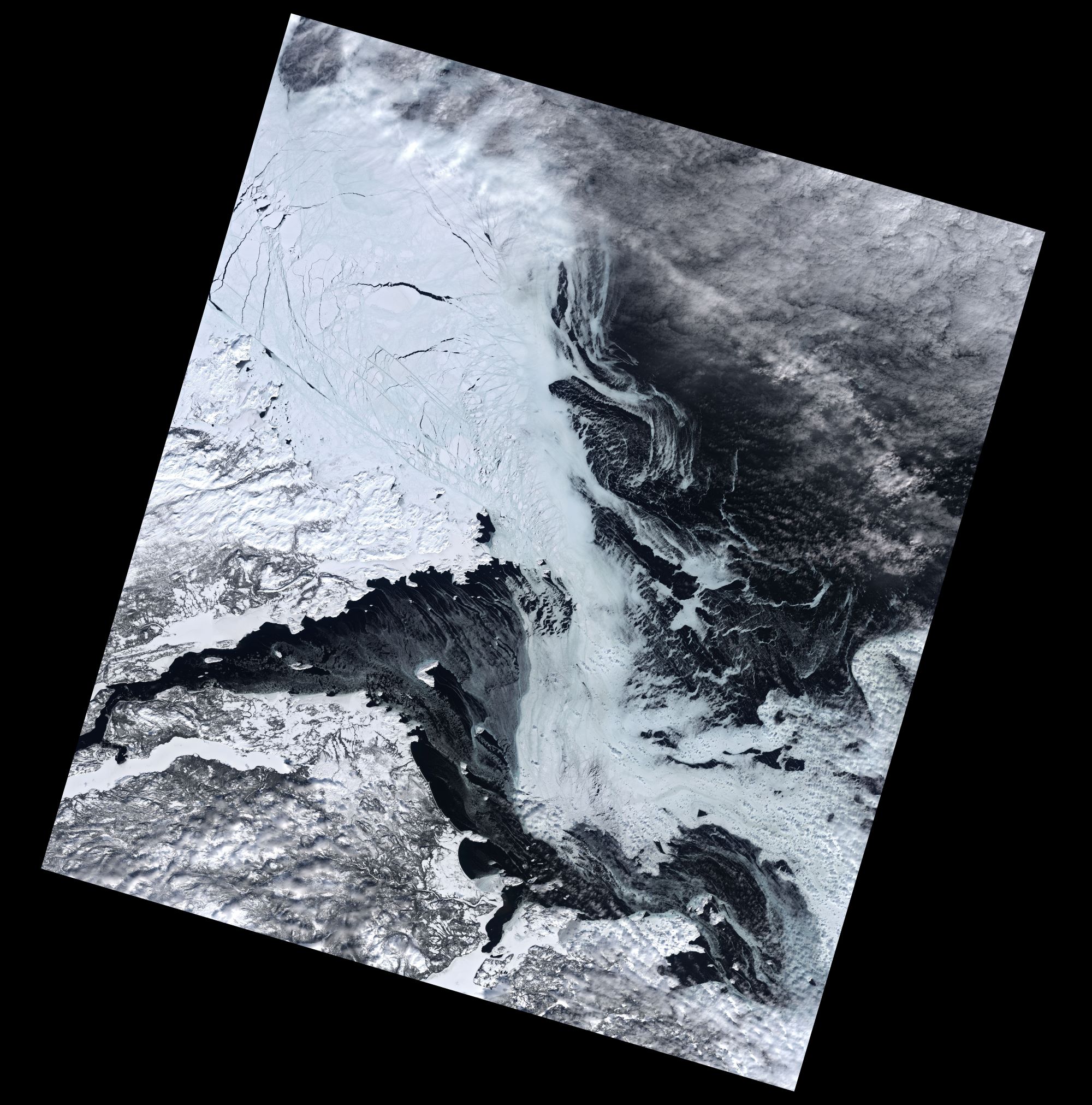
[:ja]NASAの地球観測衛星Landsat 8が撮影したカナダ、ニューファンドランド・ラブラドール州の雪解けの様子です。グロスウォーター湾の氷がかなり薄くなっています。
ニューファンドランド・ラブラドール州は、カナダダ北東部に位置するラブラドール半島東部のラブラドール地方とニューファンドランド島から成ります。ラブラドル半島は全般に寒冷で、樹木は生育できるが農作物の栽培には適しません。半島北部はツンドラである一方、ニューファンドランド島は海洋性気候です。寒流のラブラドル海流と暖流のメキシコ湾流が沖合いでぶつかり、海底地形も大陸棚が突き出たグランドバンクなどが存在するため、ニューファンドランド島もラブラドールも好漁場です。16世紀以来ヨーロッパの漁師たちが来航してこれらの海岸に入植地を作りました。
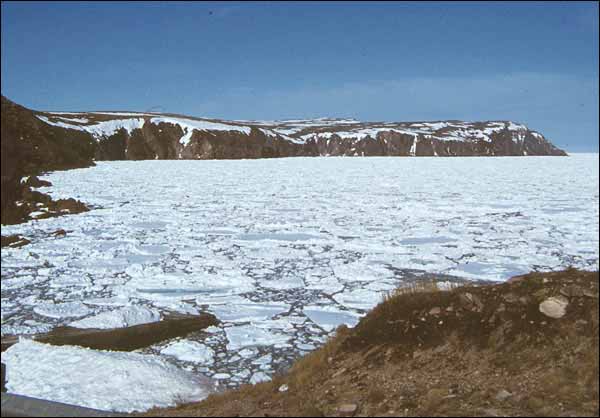
地上の様子はこちらです。
参考文献: NASA Earth’s Tweet
地球俯瞰画像を見る: LiVEARTH
[Earthview Wonders] No.1529: Spring in Newfoundland and Labrador🇨🇦
NASA’s Landsat 8 satellite captured the snow thaw in Newfoundland and Labrador, Canada. You can notice the ice getting thinner in Labrador’s Groswater Bay.
Newfoundland and Labrador is the easternmost province of Canada, in the country’s Atlantic region. It is composed of the island of Newfoundland and the continental region of Labrador to the northwest. The province has been divided into six climate types, but broadly Newfoundland has a cool summer subtype of a humid continental climate, which is greatly influenced by the sea since no part of the island is more than 100km from the ocean. Northern Labrador is classified as a polar tundra climate, southern Labrador has a subarctic climate. Sometime before 1563 Basque fishermen, who had been fishing cod shoals off Newfoundland’s coasts since the beginning of the sixteenth century, founded Plaisance (today Placentia), a seasonal haven which French fishermen later used.
The local scenery on the ground is as follows.
Reference: NASA Earth’s Tweet
See earthview photo gallery: LiVEARTH[:]