[:ja]トマ・ペスケ宇宙飛行士がISSから撮影したナミビアの大西洋岸です。画像中心付近にブランドバーグ山も見えています。
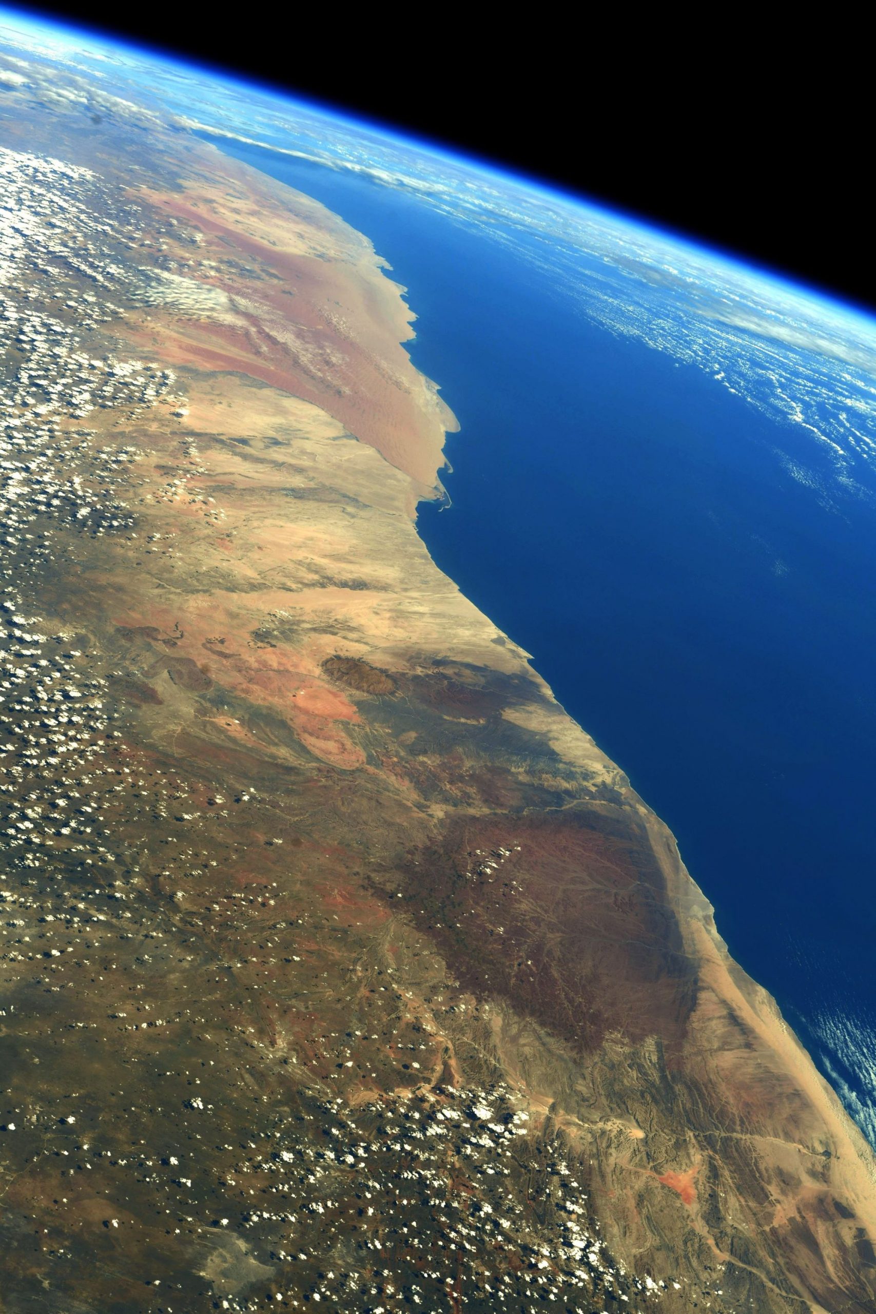
ナミビアはイギリス連邦加盟国の一つで、当初ドイツ(一部イギリス)が植民地とし、植民地時代の名称は南西アフリカでした。第二次世界大戦後は南アフリカが併合を行い、その後、1966年にナミビア独立戦争が始まり、1990年に独立を達成しました。ナミビアは全土が乾燥帯に属し、海岸部および南部が砂漠気候、北東部はステップ気候に属しています。西側の大西洋岸には海岸低地が広がっていますが、幅は約100キロ程度でそれほど広くはありません。この海岸低地は付近を流れる寒流のベンゲラ海流の影響によって大気が安定しており降雨がほとんどないため、極度の乾燥地帯となっており、世界で最も古いといわれるナミブ砂漠が広がっています。また、画像中央に見える円形の台地のように見える場所が同国最高地点のブランドバーグ山です。ブランドバーグ山の標高は2606mで、花崗岩質の岩石でできている山体は、約650km2にわたって広がっています。
ブランドバーグ山の地上の様子はこちらです。

参考文献: Thomas Pesquet’s Tweet
地球俯瞰画像を見る: LiVEARTH
[Earthview Wonders] No.1545: Namibia🇳🇦
Astronaut Thomas Pesquet captured from ISS Namibia. Near the middle of the image lies the Brandberg Mountain.
The driest country in sub-Saharan Africa, Namibia has been inhabited since pre-historic times by the San, Damara and Nama people. Around the 14th century, immigrating Bantu peoples arrived as part of the Bantu expansion. Being situated between the Namib and the Kalahari deserts, Namibia has the least rainfall of any country in sub-Saharan Africa. The Namibian landscape consists generally of 5 geographical areas, each with characteristic abiotic conditions and vegetation, with some variation within and overlap between them: the Central Plateau, the Namib, the Great Escarpment, the Bushveld, and the Kalahari Desert. The Namib is a broad expanse of hyper-arid gravel plains and dunes that stretches along Namibia’s entire coastline. It varies between 100-200km in width. Areas within the Namib include the Skeleton Coast and the Kaokoveld in the north and the extensive Namib Sand Sea along the central coast.
The local scenery on the ground is as follows.
Reference: Thomas Pesquet’s Tweet
See earthview photo gallery: LiVEARTH[:]