[:ja]オレグ・ノビツキー宇宙飛行士がISSから撮影したロシアのハバロフスクです。近年アムール川の洪水が頻繁に起きるようになり、ノビツキー氏も川面の上昇のリスクを指摘しています。
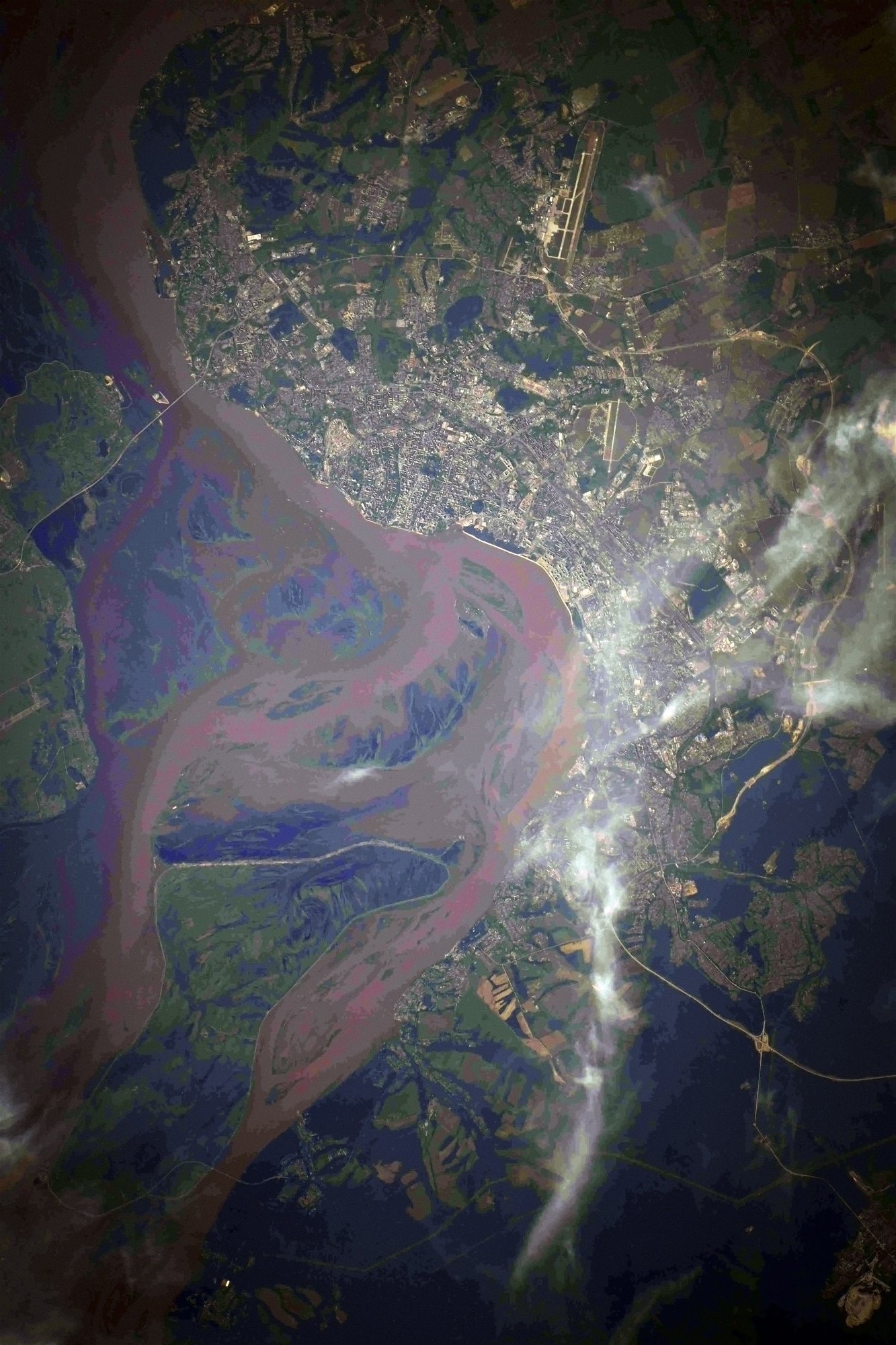
人口約62万人を擁するハバロフスクはロシア極東部の都市で、極東部では最大です。アムール川の右岸中流域に位置し、ウスリー川との合流点のすぐ下流にあります。地域経済の中心として機械工業や金属工業、木材業が発達しています。アムール川の対岸にある中国領からは30kmの距離にあり、アムール川とウスリー川の合流点にある大ウスリー島(中国名:黒瞎子島)は中ソ国境紛争の重要な係争地となっていました。なお、2004年に国境確定問題は決着し、大ウスリー島がロシアと中国の共同管理に置かれる事で合意したため、ハバロフスクに対する軍事上のリスクはほぼ完全に解消され、2008年には国境線が最終的に確定しました。これらの川は冬季には長期間凍結します。
地上の様子はこちらです。

参考文献: Oleg Novitskiy’s Tweet
地球俯瞰画像を見る: LiVEARTH
[Earthview Wonders] No.1626: Khabarovsk🇷🇺
Astronaut Oleg Novitskiy captured from ISS Khabarovsk, Russia. Recently Amur River floods frequently take place, and Novitskiy points out the risk of increasing water level.
Khabarovsk is the largest cities in the Russian Far East, and is located 30km from the China-Russia Border, at the confluence of the Amur and Ussuri Rivers. As typical of the interior of the Russian Far East, Khabarovsk has an extreme climate with very strong seasonal swings resulting in strong winter cold and relatively hot and humid summers. (Credit: Oleg Novitskiy, Roscosmos)
The local scenery on the ground is as follows.
Reference: Oleg Novitskiy’s Tweet
See earthview photo gallery: LiVEARTH[:]