[:ja]サマンサ・クリストフォレッティ宇宙飛行士がISSから撮影したチリです。9月18日は同国の独立記念日でした。
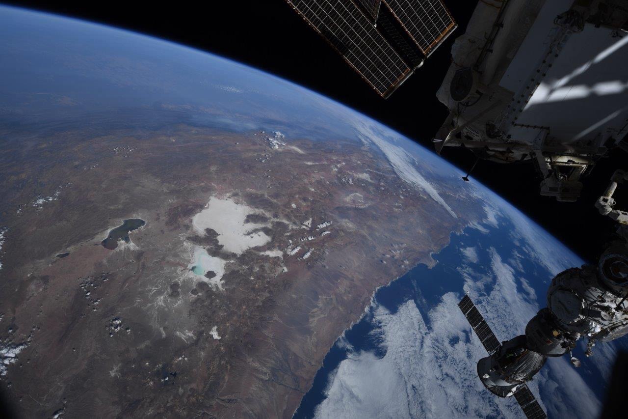
植民地支配下にあったチリは1810年9月18日に政治委員会を設立、独立への足がかりとしました。それ以来、チリでは9月18日を含む前後4日間、独立を祝う行事が連日開催されます。チリの国土はアンデス山脈西側で南北に細長く、東にアルゼンチン、北東にボリビア、北にペルーと隣接しています。西は南太平洋、南はフエゴ島を挟んでドレーク海峡に面しています。アルゼンチンとともに南アメリカ最南端に位置し、国土の大部分がコーノ・スールの域内に収まります。また、太平洋上に浮かぶフアン・フェルナンデス諸島や、サン・フェリクス島、サン・アンブロシオ島およびポリネシアのサラ・イ・ゴメス島、パスクア島(イースター島)などの離島も領有しており、さらにアルゼンチンやイギリスなどと同様に「チリ領南極」として125万km2にも及ぶ南極の領有権を主張しています。
地上の様子はこちらです。

参考文献: Samantha Cristoforetti’s Tweet
地球俯瞰画像を見る: LiVEARTH
[Earthview Wonders] No.1641: Chile🇨🇱
Astronaut Samantha Cristoforetti captured from ISS Chile. Sept. 18 was the National Day (Fiestas Patrias) of Chile.
In 1808, Napoleon’s enthronement of his brother Joseph as the Spanish King precipitated the drive by the colony for independence from Spain. A national junta in the name of Ferdinand – heir to the deposed king – was formed on September 18, 1810. The Government Junta of Chile proclaimed Chile an autonomous republic within the Spanish monarchy, and in memory of this day, Chile celebrates its National Day on September 18 each year. It is the southernmost country in the world, and the closest to Antarctica, occupying a long and narrow strip of land between the Andes to the east and the Pacific Ocean to the west. It shares land borders with Peru to the north, Bolivia to the north-east, Argentina to the east, and the Drake Passage in the far south. Chile also controls the Pacific islands of Juan Fernández, Isla Salas y Gómez, Desventuradas, and Easter Island in Oceania. (Credit: Samantha Cristoforetti, ESA, NASA)
The local scenery on the ground is as follows.
Reference: Samantha Cristoforetti’s Tweet
See earthview photo gallery: LiVEARTH[:]