[:ja]NASAの地球観測衛星Aquaが撮影した、アマゾンの焼き畑や農地開墾に伴う煙と森林減少の様子です。ブラジルとボリビアの国境付近です。
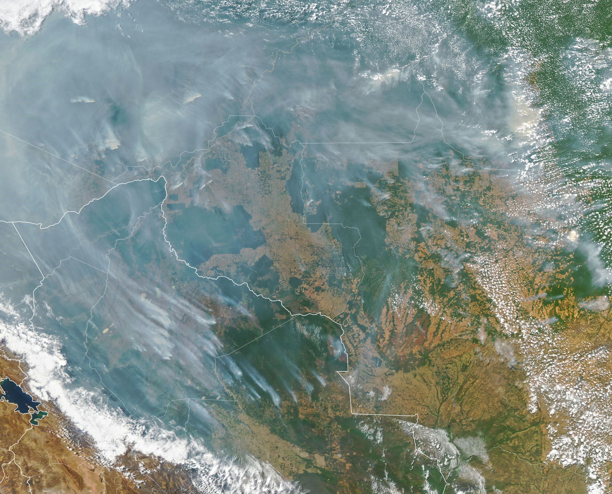
2018年の人工衛星のデータによると、2017年から2018年の間に7900km2の熱帯雨林が失われたとされています。世界自然保護基金WWFは、2030年までに、最大でアマゾン熱帯雨林の60%が破壊され、この影響で二酸化炭素の排出量が555億トンから969億トンに増える可能性があることを報告しました。
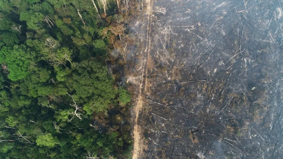
地上の様子はこちらです。
参考文献: NASA Earth’s Tweet
地球俯瞰画像を見る: LiVEARTH
[Earthview Wonders] No.1642: Amazon Deforestation🇧🇷🇧🇴
NASA’s Aqua satellite captured the smokes arising in the Amazon area aiming to dispose of piles of leftover wood, and expand agriculture in the region. The image shows the area near the boundary of Brazil and Bolivia
The cattle sector of the Brazilian Amazon, incentivized by the international beef and leather trades, has been responsible for about 80% of all deforestation in the region, or about 14% of the world’s total annual deforestation, making it the world’s largest single driver of deforestation. According to 2018 satellite data compiled by a deforestation monitoring program called Prodes, deforestation has hit its highest rate in a decade. About 7,900km2 of the rainforest was destroyed between August 2017 and July 2018.
The local scenery on the ground is as follows.
Reference: NASA Earth’s Tweet
See earthview photo gallery: LiVEARTH[:]