[:ja]サマンサ・クリストフォレッティ宇宙飛行士がISSから撮影したマルタです。9月21日はマルタの独立記念日でした。
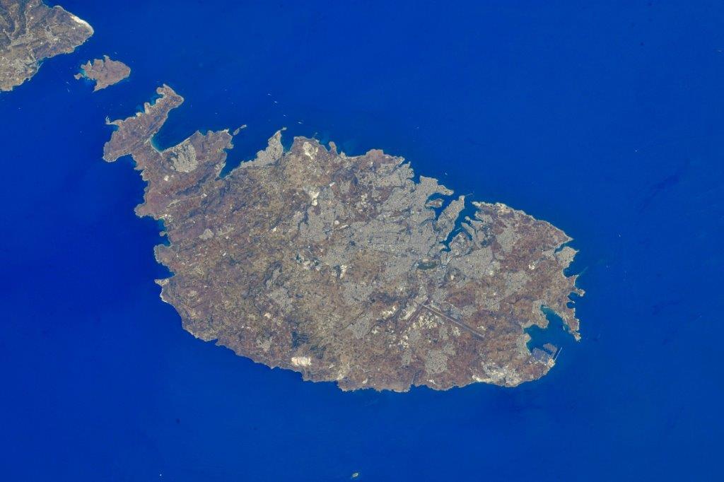
マルタ島は、イタリア、シチリア島の南93kmほどのところにあります。島の東部には首都バレッタがあり、市街は世界遺産となっています。海岸沿いの入り組んだ入り江は美しい港の景観を創りだし、密集した人家の風景は高台のある丘が特徴的です。地中海性の温暖な気候で、冬は温暖で雨が多く、夏は暑く乾いています。マルタ猫が非常に多く生息しておりその数は70万匹以上と人口の倍近くの数を占めます。他の多くの猫を掻い潜ってエサを獲得する為にそれぞれが前足を使ってエサを口に運ぶのがこの島の猫達の大きな特徴にもなっています。また、マルタはマルチーズ犬の原産地でもあります。1964年9月21日、マルタはイギリスから独立し、この10年後の1974年9月21日、正式に「マルタ共和国」になりました。
地上の様子はこちらです。

参考文献: Samantha Cristoforetti’s Tweet
地球俯瞰画像を見る: LiVEARTH
[Earthview Wonders] No.1644: Malta🇲🇹
Astronaut Samantha Cristoforetti captured from ISS Malta. Sept. 21 was the Independence Day of Malta.
Malta is the largest of the three major islands that constitute the Maltese archipelago. Malta is in the middle of the Mediterranean Sea directly south of Italy and north of Libya. The island is 27km long and 14.5km wide. The capital is Valletta, while the largest locality is Rabat. The island is made up of many small towns, which together form one larger urban zone with a population of 409,259. The landscape is characterised by low hills with terraced fields. The British ruled for about 150 years and Malta became independent in 1964. Ten years later the State of Malta became the Republic of Malta. Malta joined the European Union in 2004 and adopted the Euro four years later. (Credit: Samantha Cristoforetti, ESA, NASA)
The local scenery on the ground is as follows.
Reference: Samantha Cristoforetti’s Tweet
See earthview photo gallery: LiVEARTH[:]