[:ja]アメリカ海洋大気庁NOAAの地球観測衛星NOAA-20が撮影した冬の米国の五大湖です。今年は暖冬で、湖の7%しか凍らず、これは1973年の観測開始以来最小の面積と報告されています。
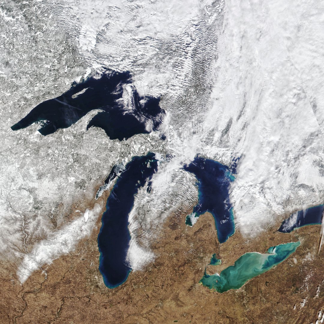
五大湖は北緯42-50度と全般的に緯度が高く、かつ内陸であるため、冬は非常に寒いです。夏も、湖の水が冷却水の役割を果たしている影響もあって、気温の高くなる地域でも体感的には涼しく感じ、わりあい凌ぎ易くなっています。あまりに寒いため、五大湖はその大きさにもかかわらず、ほとんどの部分が冬季には結氷し、五大湖を経由する河川運輸は冬には停止されます。
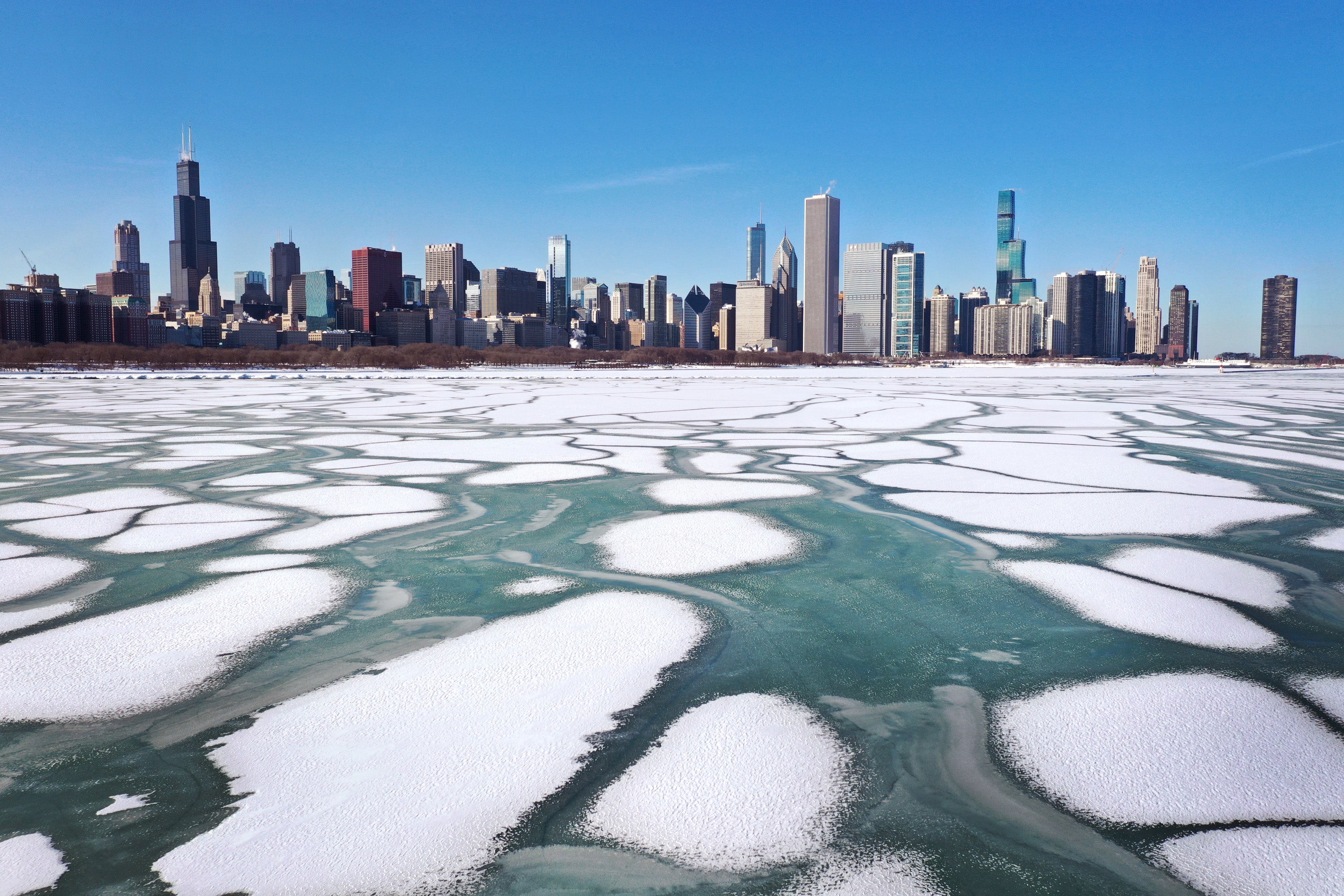
地上の様子はこちらです。
参考文献: NASA Earth’s Tweet, Low ice on the Great Lakes this winter
地球俯瞰画像を見る: LiVEARTH
[Earthview Wonders] No.1749: Wintry Great Lakes🇺🇸
NOAA-20 satellite captured the Great Lakes in winter. In this image, ice cover on the lake was 7% which is the lowest ice cover measured on this date of any year since 1973 when satellite-based record keeping began.
The Great Lakes are a series of interconnected freshwater lakes primarily in the upper mid-east region of North America, on the Canada–United States border, which connect to the Atlantic Ocean through the Saint Lawrence River. The Great Lakes have a humid continental climate, and winter becomes severe without which halts over-the-water transportation.
The local scenery on the ground is as follows.
Reference: NASA Earth’s Tweet, Low ice on the Great Lakes this winter
See earthview photo gallery: LiVEARTH[:]