[:ja]ESAの地球観測衛星Sentinel 2が撮影したアイスランドのヴァトナヨークトル国立公園です。
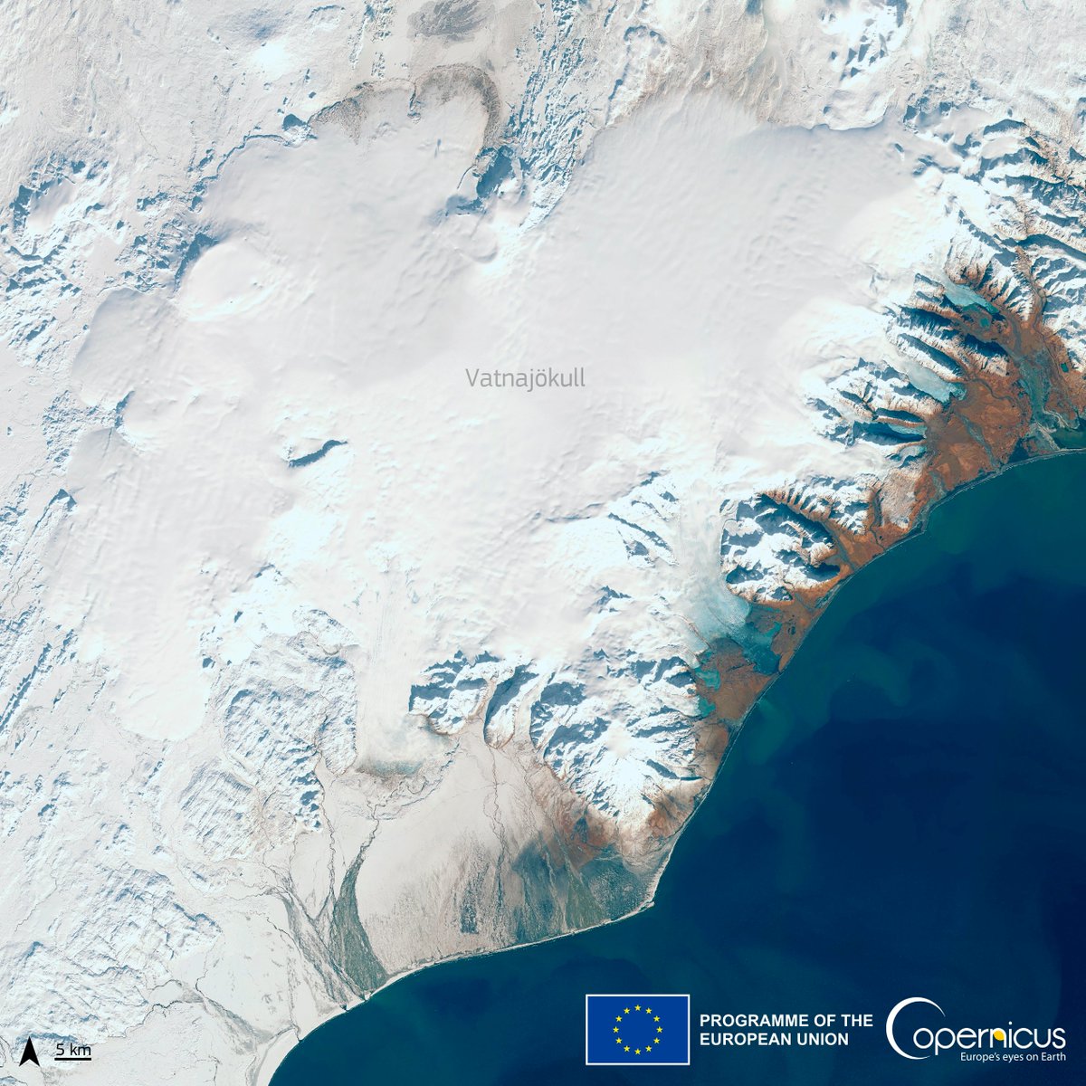
アイスランド南東部にあるヴァトナヨークトル国立公園は、アイスランドの14%を占める極めて広大な火山地帯であり、世界遺産です。2008年にスカフタフェットル国立公園とヨークルスアゥルグリューフル国立公園の2つが統合してヴァトナヨークトル国立公園となりましたが、名称はヨーロッパ最大の氷河である、ヴァトナヨークトル氷河にちなんでいます。火山活動と氷河が形成した独特な景観が特徴。2019年7月5日に、「火と氷の絶えず変化する自然」として、世界自然遺産に登録されました。ちなみに、ヴァトナヨークトル氷河はヨーロッパ最大の氷河で面積は8100km2と広大で、おおよその厚さは400~600mで、場所によっては最大950mにもなります。中央部には活火山が点在し最も大きいのはバルサルブンガ山です。
地上の様子はこちらです。

参考文献: Copernicus EU’s Tweet
地球俯瞰画像を見る: LiVEARTH
[Earthview Wonders] No.1753: Vatnajökull National Park🇮🇸
ESA’s Sentinel 2 captured Vatnajökull National Park, Iceland.
https://upload.wikimedia.org/wikipedia/commons/thumb/d/d7/Breidamerkurjoekull.jpg/2880px-Breidamerkurjoekull.jpg
Credit: Wikipedia
Vatnajökull National Park, Iceland, encompasses all of Vatnajökull glacier and extensive surrounding areas. These include the national parks previously existing at Skaftafell in the southwest and Jökulsárgljúfur in the north. The unique qualities of Vatnajökull National Park are primarily its great variety of landscape features, created by the combined forces of rivers, glacial ice, and volcanic and geothermal activity. On July 5, 2019, Vatnajökull National Park was inscribed as a World Heritage Site.
The local scenery on the ground is as follows.
Reference: Copernicus EU’s Tweet
See earthview photo gallery: LiVEARTH[:]