[:ja]若田光一宇宙飛行士がISSから撮影した沖縄県です。
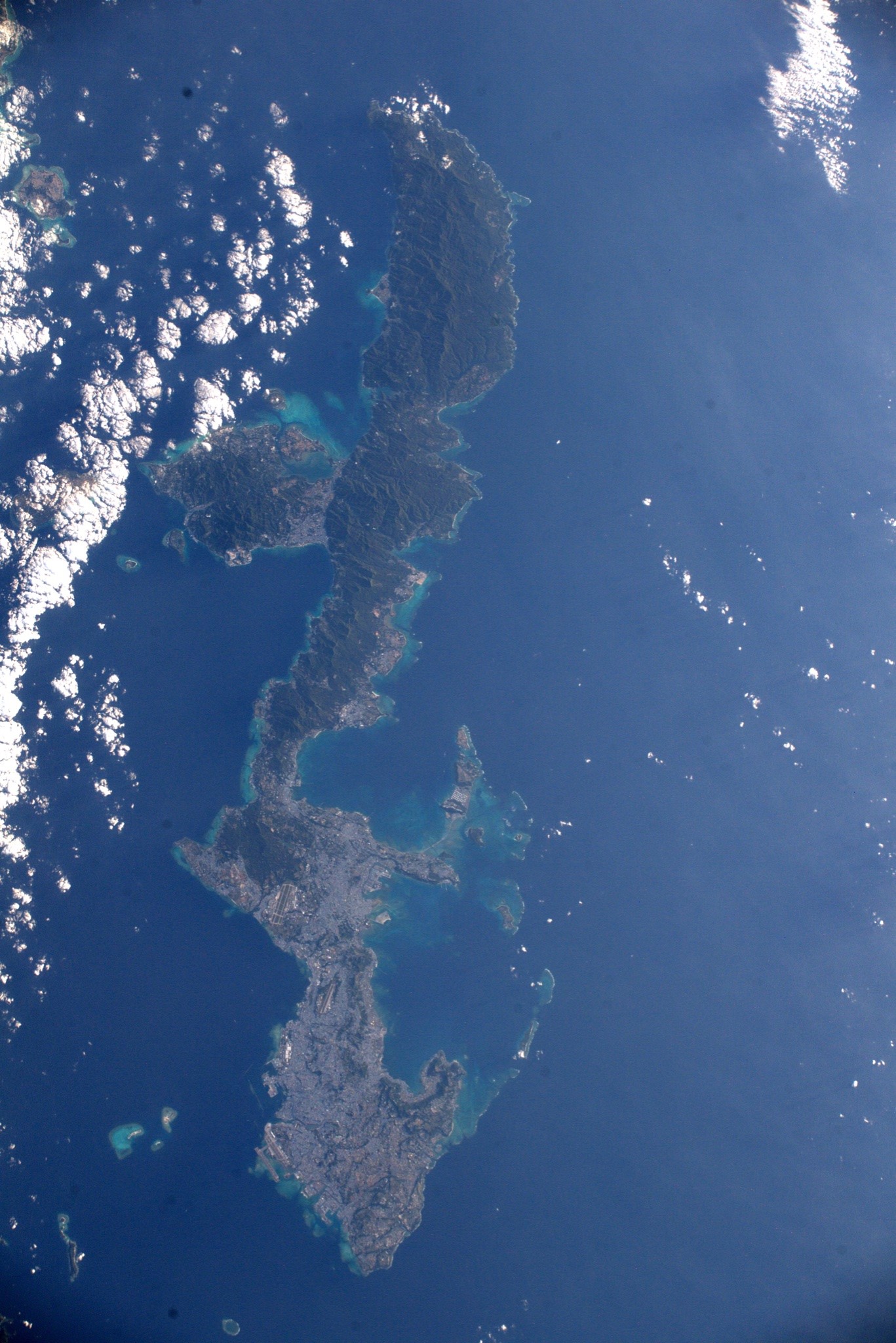
沖縄県は鹿児島県の薩南諸島を除く南西諸島の島々(沖縄諸島、先島諸島、大東諸島)から構成されており、東シナ海と太平洋に挟まれています。県民人口の約9割が沖縄本島に集中しており、さらに本島中南部に県人口の8割が集中しています。那覇市中心部は三大都市圏に匹敵する人口密度があります。歴史的経緯(後述)から、宗教、文化並びに風習、人名や方言、料理や食文化及び産業、人口構成ならびに所得格差に至るまで日本列島主要四島との差異が大きいです。俗に沖縄「県外」のことを「内地(ナイチ)」、沖縄県外の日本人を「内地人(ナイチャー)」と呼び分ける場合があります。
地上の様子はこちらです。

参考文献: Koichi Wakata’s Tweet
地球俯瞰画像を見る: LiVEARTH
[Earthview Wonders] No.1761: Okinawa🇯🇵
Astronaut Koichi Wakata captured from ISS Okinawa, Japan.
Okinawa Prefecture is the southernmost and westernmost prefecture of Japan and has a population of about 1.5 million. Naha is the capital and largest city, with other major cities including Okinawa, Uruma, and Urasoe. Okinawa Prefecture encompasses two thirds of the Ryukyu Islands, including the Okinawa, Daitō and Sakishima groups, extending 1,000km southwest from the Satsunan Islands of Kagoshima Prefecture to Taiwan (Hualien and Yilan Counties). Okinawa Prefecture’s largest island, Okinawa Island, is the home to a majority of Okinawa’s population. Okinawa’s indigenous ethnic group are the Ryukyuan people, who also live in the Amami Islands of Kagoshima Prefecture. Okinawa was ruled by the Ryukyu Kingdom from 1429 and annexed by Japan after the Invasion of Ryukyu in 1609.
The local scenery on the ground is as follows.
Reference: Koichi Wakata’s Tweet
See earthview photo gallery: LiVEARTH[:]