Astronaut Soichi Noguchi captured from ISS Gulf of Khambhat, Gujarat, India.
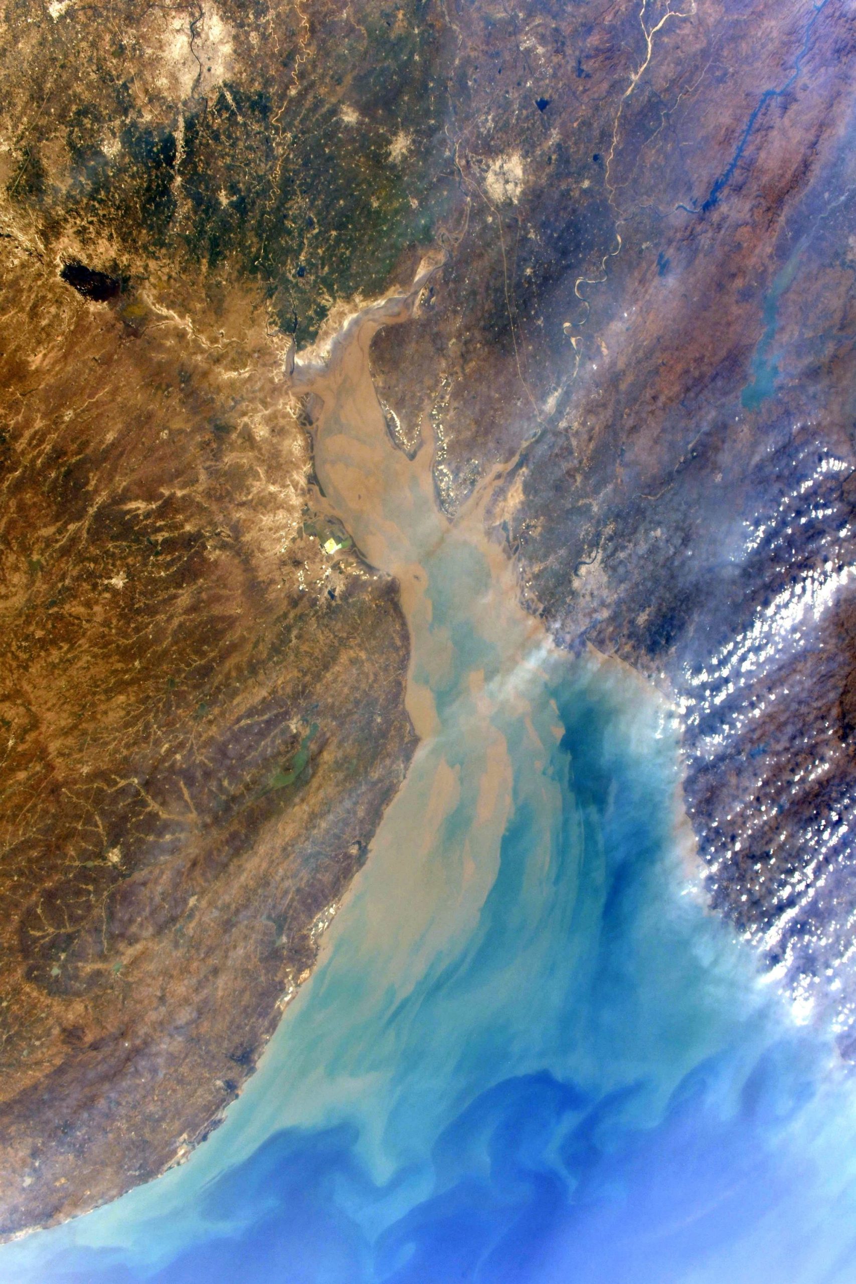
The Gulf of Khambhat, historically known as the Gulf of Cambay, is a bay on the Arabian Sea coast of India, bordering the state of Gujarat just north of Mumbai and Diu Island. The Gulf of Khambhat is about 200km long, about 20km wide in the north and up to 70km wide in the south. Major rivers draining Gujarat are the Narmada, Tapti, Mahi and the Sabarmati, that form estuaries in the gulf. It divides the Kathiawar Peninsula from the south-eastern part of Gujarat. There are plans to construct a 30km dam, Kalpasar Project, across the gulf.
To the north of the image lies Ahmedabad, a large Gujarat city. Ahmedabad has emerged as an important economic and industrial hub in India. It is the second largest producer of cotton in India, and its stock exchange is the country’s second oldest. The effects of liberalization of the Indian economy have energized the city’s economy towards tertiary sector activities such as commerce, communication and construction.
The local scenery on the ground is as follows.

Reference: Soichi Noguchi’s Tweet
See earthview photo gallery: LiVEARTH