Astronaut Matthias Maurer captured from ISS Cook Strait which separates the North and South Island of New Zealand in summer.
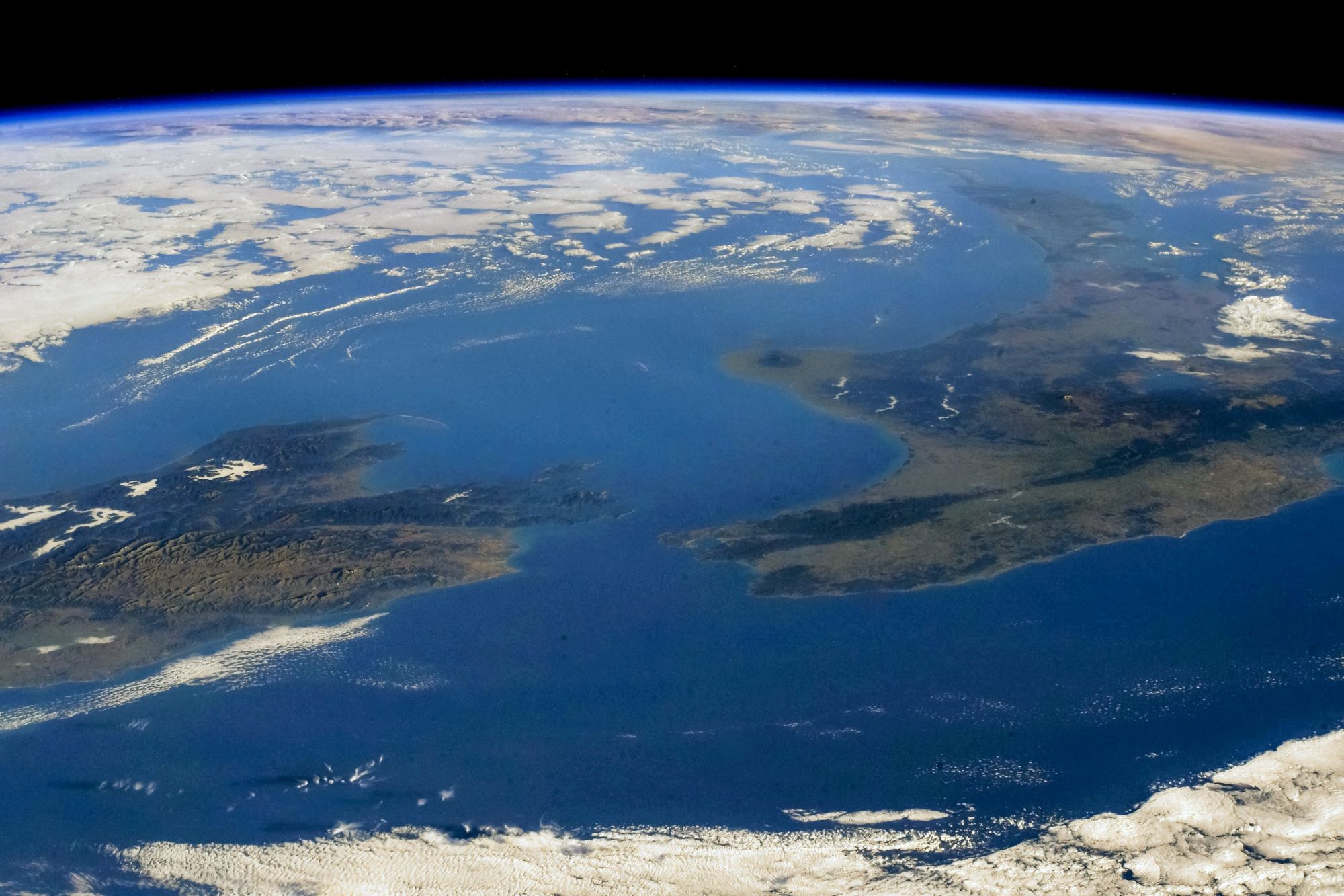
Cook Strait connects the Tasman Sea on the northwest with the South Pacific Ocean on the southeast, and runs next to the capital city, Wellington. It is 23km wide at its narrowest point, and is considered one of the most dangerous and unpredictable waters in the world. Though the strait was first discovered by Dutch explorer Abel Tasman in 1642, he thought Cook Strait was a bight closed to the east, and was eventually named after James Cook, the first European commander to sail through it, in 1769.
The local scenery on the ground is as follows.

Reference: Matthias Maurer’s Tweet
See earthview photo gallery: LiVEARTH