NASA’s Terra satellite captured the Guadalupe Island, Mexico, and wave clouds.
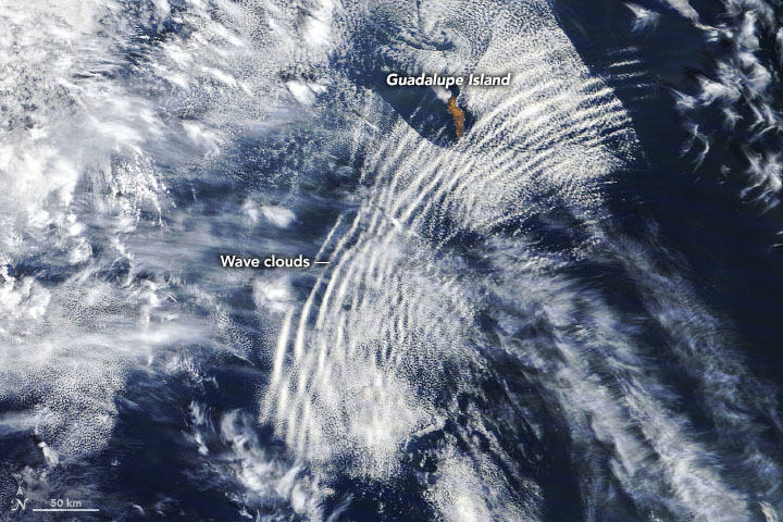
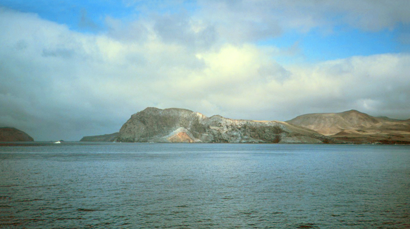
Guadalupe Island is a volcanic island located 241km off the western coast of Mexico’s Baja California Peninsula in the Pacific Ocean. The various volcanoes are extinct or dormant. In 2005 Guadalupe Island and its surrounding waters and islets were declared a biosphere reserve to restore its vegetation (decimated by feral goats) and to protect its population of marine mammals and birds. The island is a popular destination for great white shark cage diving. Guadalupe Island is inhabited only by scientists, military personnel operating a weather station, and a small group of seasonal fishermen. The island is mostly arid and has very little surface water.
Also, a wave cloud is a cloud form created by atmospheric internal waves. The atmospheric internal waves that form wave clouds are created as stable air flows over a raised land feature such as a mountain range, and can form either directly above or in the lee of the feature. As an air mass travels through the wave, it undergoes repeated uplift and descent.
It is possible that simple convection from mountain summits can also form wave clouds. This occurs as the convection forces a wave or lenticular wave cloud into the more stable air above.[2]
The local scenery on the ground is as follows.
Reference: NASA Earth’s Tweet
See earthview photo gallery: LiVEARTH