NASA’s Terra satellite captured the Gulf of Kutch, Gujarat, India.
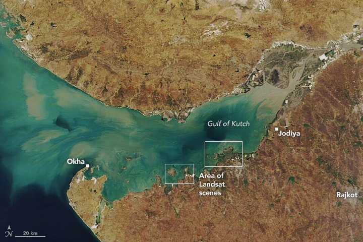
The Gulf of Kutch is located between the peninsula regions of Kutch and Saurashtra, bounded in the state of Gujarat that borders Pakistan. It opens towards the Arabian Sea facing the Gulf of Oman. It is about 50km wide at the entrance before narrowing into marshland, creeks and inlets. The south coast is bordered by islands, mud flats and coral reefs, due to the large amount of marine life found in this region it has large sections of it have become protected as parks and sanctuaries. The northern side is lined with extensive mud flats, the largest of which lie between Mundra and Kuvay. Maximum depth of the Gulf of Kutch is around 123m. Tidal conditions range with spring tide peaking around 6.2m while the annual average is around 4m. Moreover, the height of the tides can also vary depending on how deep into the gulf it’s recorded.
The local scenery on the ground is as follows.

Reference: NASA Earth’s Tweet
See earthview photo gallery: LiVEARTH