Landsat 8 satellite captured Ha Long Bay, Vietnam.
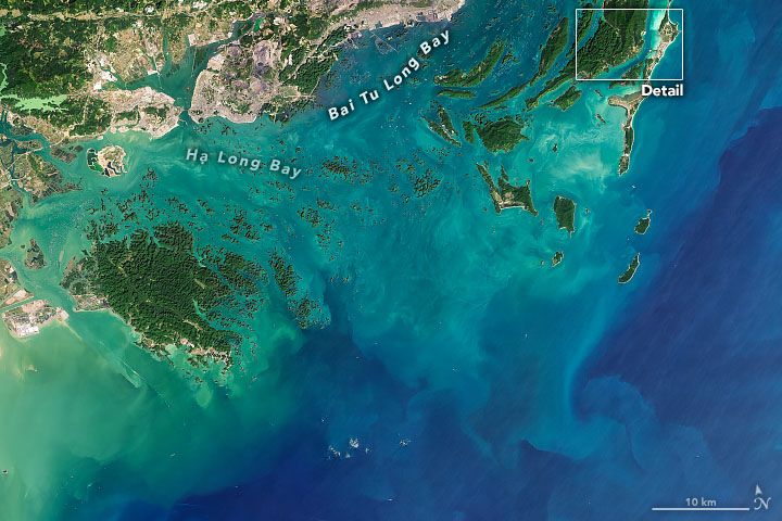
Hạ Long Bay or Halong Bay is a UNESCO World Heritage Site and popular travel destination in Quảng Ninh province, Vietnam. The name Hạ Long means “descending dragon”. Administratively, the bay belongs to Hạ Long city, Cẩm Phả city, and is a part of Vân Đồn district. The bay features thousands of limestone karsts and islets in various shapes and sizes. Hạ Long Bay has an area of around 1,553km2, including 1969 islets, most of which are limestone. The evolution of the karst in this bay has taken 20 million years under the impact of the tropical wet climate. The geo-diversity of the environment in the area has created biodiversity, including a tropical evergreen biosystem and a seashore biosystem. Hạ Long Bay is home to 14 endemic floral species and 60 endemic faunal species.
The local scenery on the ground is as follows.

Reference: NASA Earth’s Tweet
See earthview photo gallery: LiVEARTH