Astronaut Koichi Wakata captured from ISS the Himalayas and Tibetan Plateau.
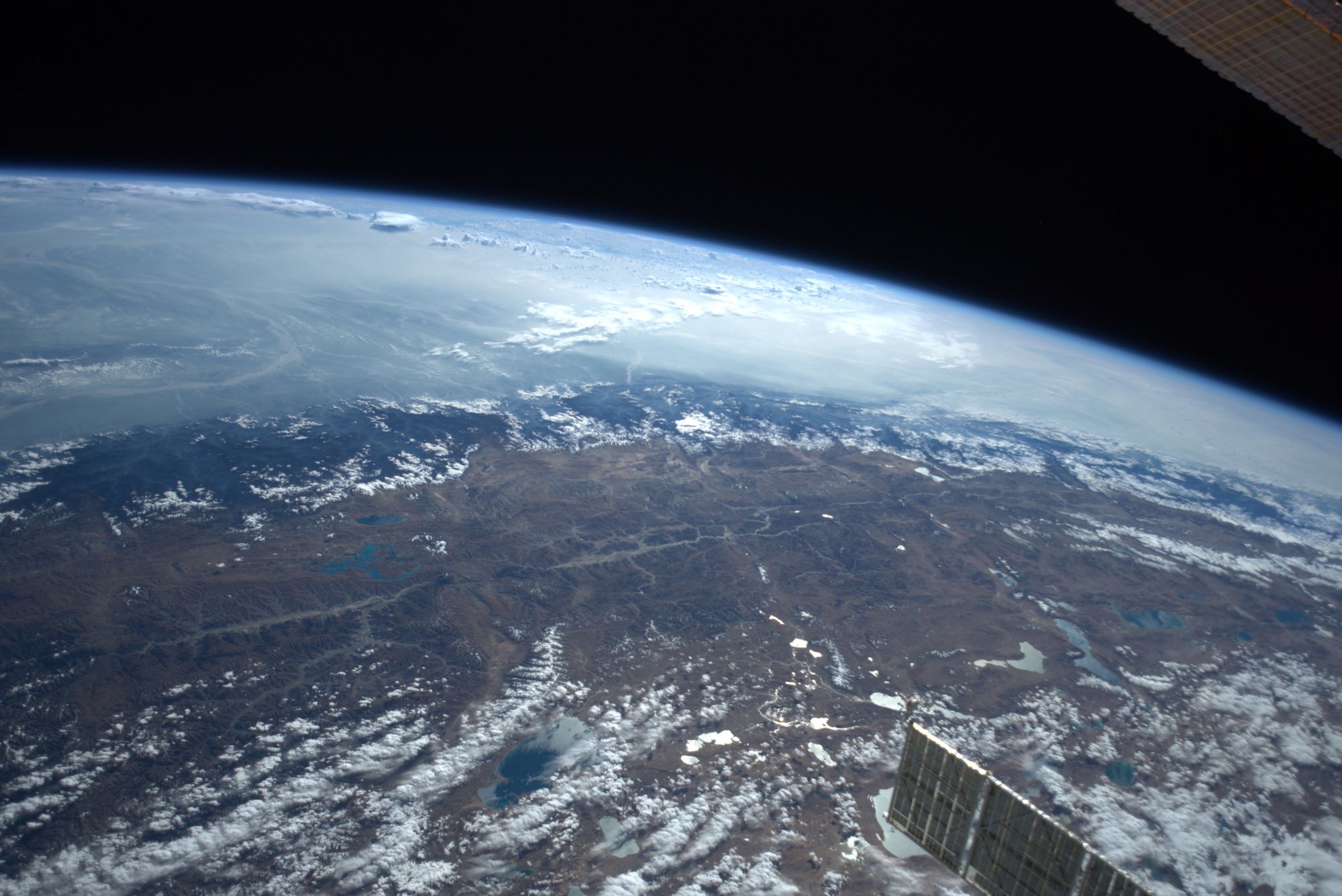
The Himalayas, or Himalaya is a mountain range in Asia, separating the plains of the Indian subcontinent from the Tibetan Plateau. The range has some of the Earth’s highest peaks, including the highest, Mount Everest; more than 100 peaks exceeding elevations of 7,200m above sea level lie in the Himalayas. The Himalayas abut or cross five countries: Nepal, China, Pakistan, Bhutan and India. Lifted by the subduction of the Indian tectonic plate under the Eurasian Plate, the Himalayan mountain range runs west-northwest to east-southeast in an arc 2,400km long.
The Tibetan Plateau or the Qing–Zang Plateau is a vast elevated plateau in Central Asia, covering most of the Tibet Autonomous Region, most of Qinghai, China. It stretches approximately 1,000km north to south and 2,500km east to west. It is the world’s highest and largest plateau above sea level. With an average elevation exceeding 4,500m and being surrounded by imposing mountain ranges that harbor the world’s two highest summits, Mt. Everest and K2, the Tibetan Plateau is often referred to as “the Roof of the World”. The Tibetan Plateau contains the headwaters of the drainage basins of most of the streams in surrounding regions. Its tens of thousands of glaciers and other geographical and ecological features serve as a “water tower” storing water and maintaining flow. Its formation is a result of a continental collision or orogeny along the convergent boundary between the Indo-Australian Plate and the Eurasian Plate.
The local scenery on the ground is as follows.

Reference: Koichi Wakata’s Tweet
See earthview photo gallery: LiVEARTH