Landsat 9 satellite captured Lake Okeechobee, Florida, U.S.
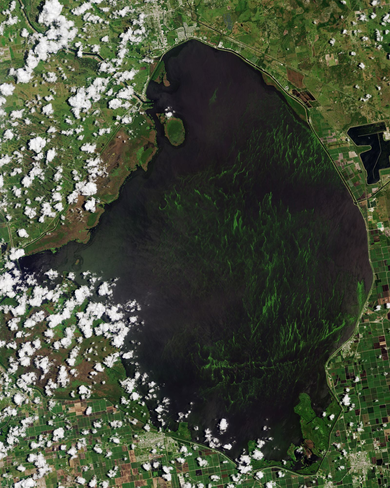
Lake Okeechobee is the largest freshwater lake in the U.S. It is exceptionally shallow for a lake of its size, with an average depth of only 2.7m. The Kissimmee River, located directly north of Lake Okeechobee, is the lake’s primary source. The name Okeechobee comes from the Hitchiti words oki (water) and chubi (big). Lake Okeechobee sits in a shallow geological trough that also underlies the Kissimmee River Valley and the Everglades. The trough is underlain by clay deposits that compacted more than the limestone and sand deposits did along both coasts of peninsular Florida. Until about 6,000 years ago, the trough was dry land. As the sea level rose, the water table in Florida also rose and rainfall increased. Along what is now the southern edge of the lake, the wetlands built up the layers of peat rapidly enough to form a dam, until the lake overflowed into the Everglades.
The local scenery on the ground is as follows.

Reference: NASA Earth’s Tweet
See earthview photo gallery: LiVEARTH