NASA’s Landsat 9 satellite captured Mahakam River, Indonesia.
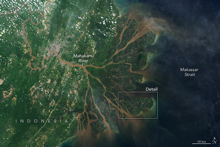
The Mahakam River (Sungai Mahakam) is 3rd longest and volume discharge river in Borneo after Kapuas River and Barito River, it is located in Kalimantan, Indonesia. It flows 980km from the district of Long Apari in the highlands of Borneo, to its mouth at the Makassar Strait. The city of Samarinda, the provincial capital of East Kalimantan, lies along 48km from the river mouth. The delta Mahakam river consist of specific micro climate which is influenced by high and low tide at sea level.
The local scenery on the ground is as follows.

Reference: NASA Landsat’s Tweet
See earthview photo gallery: LiVEARTH