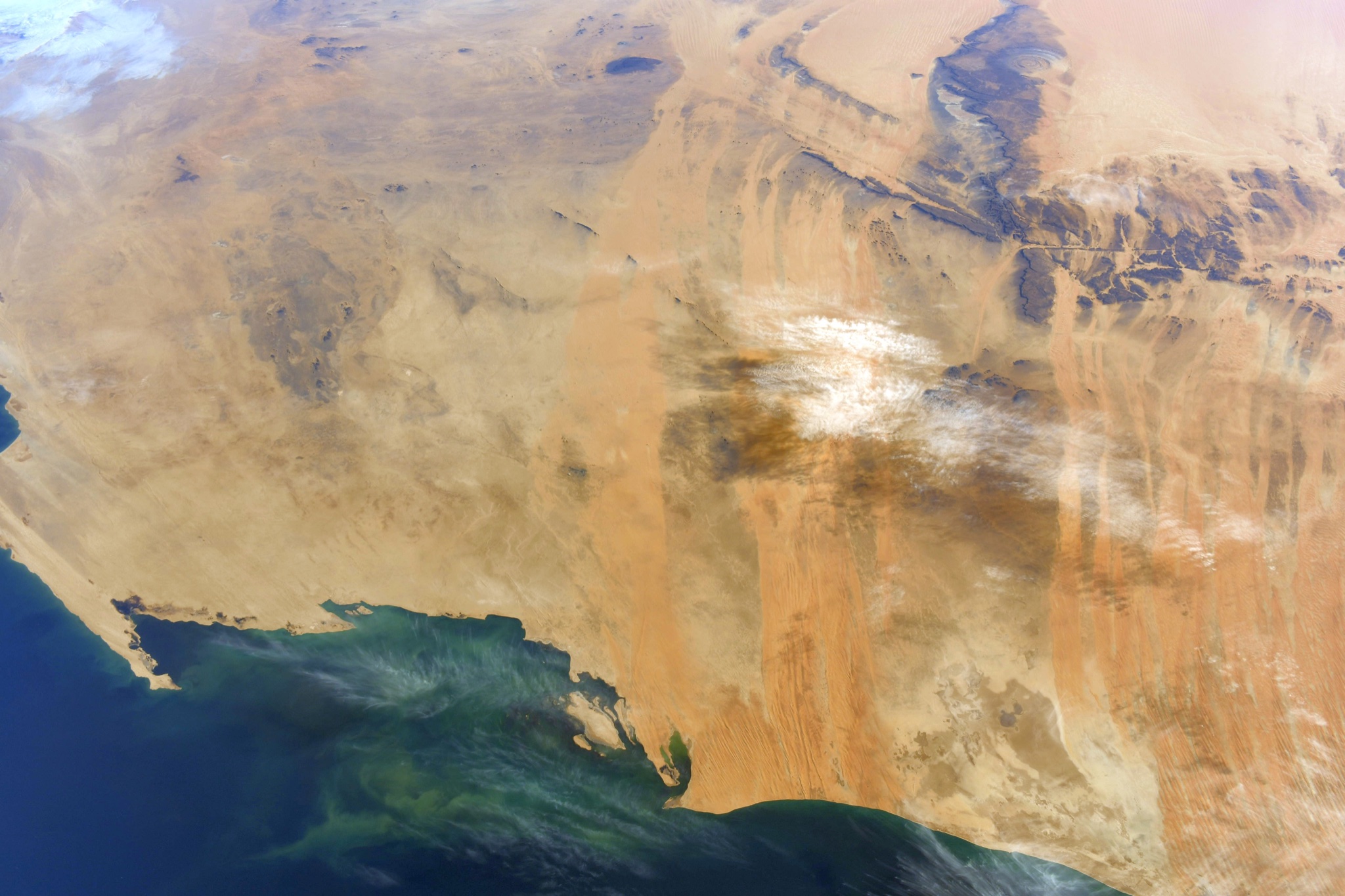
Astronaut Soichi Noguchi captured from ISS Mauritania and Richat Structure.
Mauritania’s name derives from the name of the ancient Berber kingdom of Mauretania, located in present-day Morocco and Algeria. In the late 19th century, during European Scramble for Africa, Mauritania became a French colony. Mauritania became independent from French West Africa in 1960. Since then, it has experienced recurrent coups and periods of authoritarian military rule. Approximately 90% of Mauritania’s land is in the Sahara. As a result, most of its inhabitants live in the south of the country, where precipitation is slightly higher. Mauritania has extensive deposits of iron ore, which account for almost 50% of total exports. Gold and copper mining companies are opening mines in the interior.
The Richat Structure, also called Guelb er Richât (Arabic قلب الريشات Qalb ar-Rīšāt), the Eye of Africa, or Eye of the Sahara, is a prominent circular feature in the Sahara’s Adrar Plateau, near Ouadane, west–central Mauritania, Northwest Africa. It is an eroded dome, 40km in diameter, exposing sedimentary rock in layers which appear as concentric rings. Igneous rock is exposed inside and there are spectacular rhyolites and gabbros which have undergone hydrothermal alteration and a central megabreccia. The structure is also the location of exceptional accumulations of Acheulean archaeological artifacts.
The local scenery on the ground is as follows.

Reference: Soichi Noguchi’s Tweet
See earthview photo gallery: LiVEARTH