Landsat 8 satellite captured Mayotte, an overseas department and region and single territorial collectivity of France.
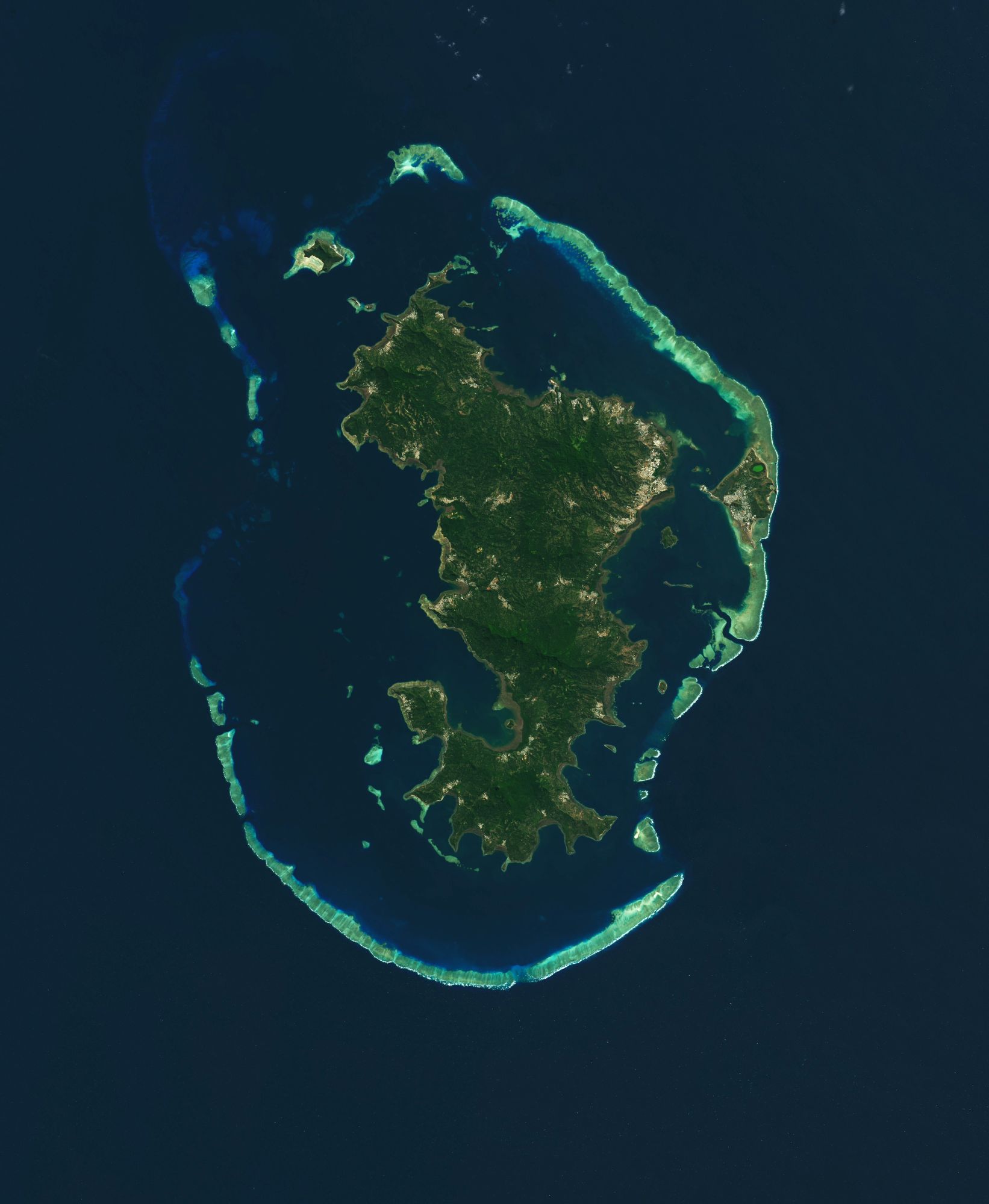
Mayotte is located in the northern part of the Mozambique Channel in the western Indian Ocean off the coast of Southeastern Africa, between the northwestern part of the island of Madagascar and northeastern Mozambique on the continent. Mayotte consists of a main island, Grande-Terre (or Maore), a smaller island, Petite-Terre (or Pamanzi), as well as several islets around these two. French is the official language and is spoken as a second language by an increasing part of the population, with 63% of the population 14 years and older reporting in the 2007 census that they could speak it. Andriantsoly, former king of Iboina on Madagascar, sold the islands in 1841 to France and its overseas French Empire, and Mayotte integrated to the Crown of France of King Louis Philippe I (1773-1850, reigned 1830-1848, of the royal dynasty of the House of Bourbon-Orleans), then seven years later with the subsequent Second French Republic (1848-1870) after the French Revolution of 1848. Mayotte chose to remain with France after the nearby Comoros declared its independence following their 1974 independence referendum. Mayotte however became the 101st department of France (Fifth French Republic) on 31 March 2011 and became an outermost associated region of the European Union on 1 January 2014, following a March 2009 referendum with an overwhelming result in favour of remaining in the status of a French department.
The local scenery on the ground is as follows.

Reference: NASA Earth’s Tweet
See earthview photo gallery: LiVEARTH