Astronaut Jessica Meir captured from ISS Namibia.
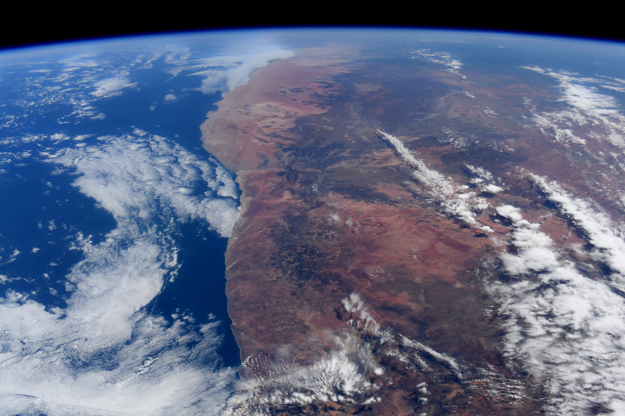
The driest country in sub-Saharan Africa, Namibia has been inhabited since pre-historic times by the San, Damara and Nama people. Around the 14th century, immigrating Bantu peoples arrived as part of the Bantu expansion. Being situated between the Namib and the Kalahari deserts, Namibia has the least rainfall of any country in sub-Saharan Africa. The Namibian landscape consists generally of 5 geographical areas, each with characteristic abiotic conditions and vegetation, with some variation within and overlap between them: the Central Plateau, the Namib, the Great Escarpment, the Bushveld, and the Kalahari Desert. The Namib is a broad expanse of hyper-arid gravel plains and dunes that stretches along Namibia’s entire coastline. It varies between 100-200km in width. Areas within the Namib include the Skeleton Coast and the Kaokoveld in the north and the extensive Namib Sand Sea along the central coast.
The local scenery on the ground is as follows.

Reference: Jessica Meir’s Tweet
See earthview photo gallery: LiVEARTH