NASA’s Landsat 8 satellite captured the false-color image of New York, U.S. The city showed the effects of a long cold spell in early January. Ice swirled in the Hudson River and snow coated the landscape.
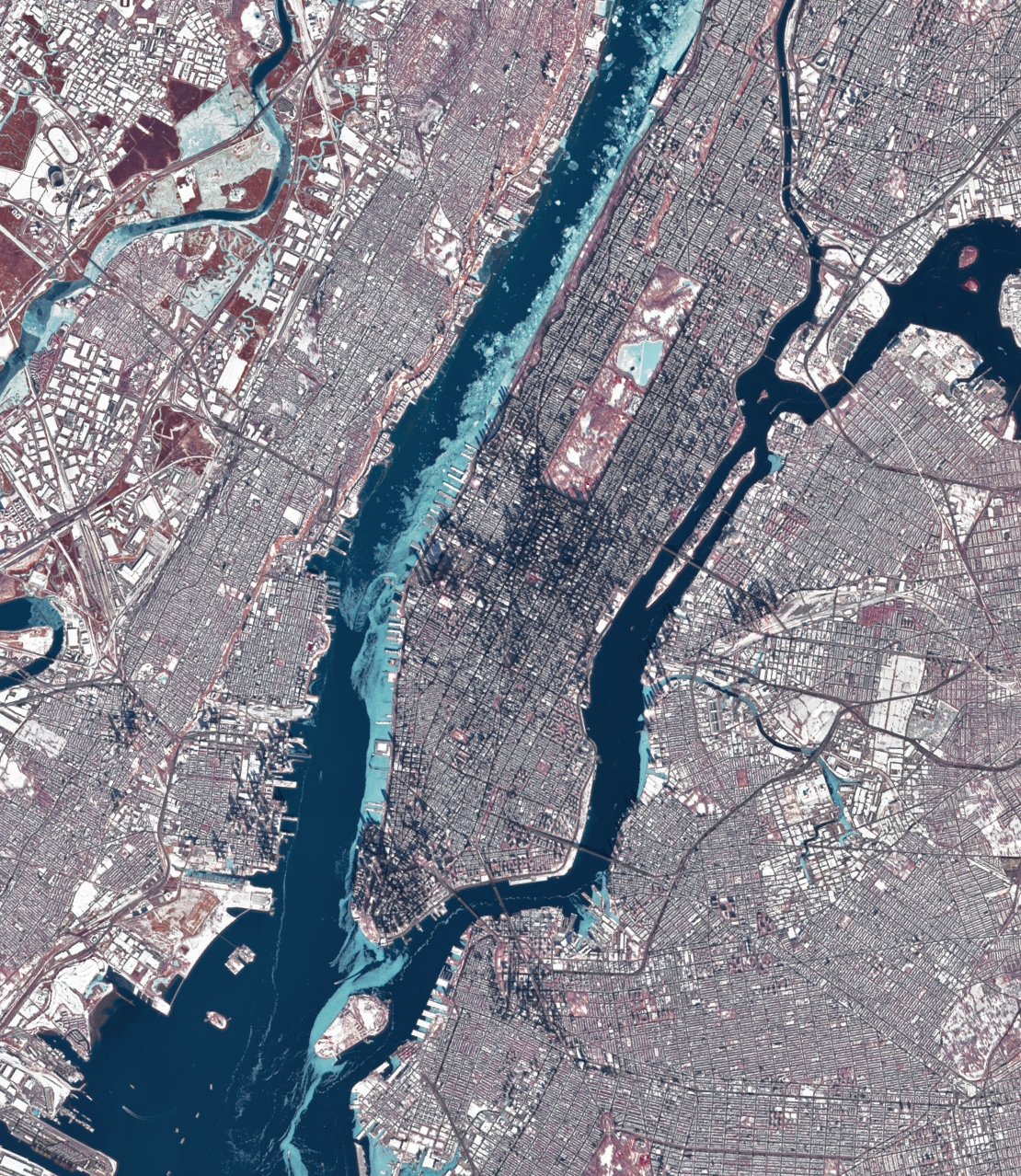
During the Wisconsin glaciation, 75,000 to 11,000 years ago, the New York City area was situated at the edge of a large ice sheet over 610m in depth. Today New York City is located at the mouth of the Hudson River, which feeds into a naturally sheltered harbor and then into the Atlantic Ocean. Most of the city is built on the three islands of Long Island, Manhattan, and Staten Island. The Hudson River separates New York City from New Jersey while the East River and the Harlem River separate the Bronx and Manhattan from Long Island. The city’s land has been altered substantially by human intervention, with considerable land reclamation along the waterfronts since Dutch colonial times; reclamation is most prominent in Lower Manhattan, with developments such as Battery Park City in the 1970s and 1980s.
The local scenery on the ground is as follows.

Reference: ‘s Tweet
See earthview photo gallery: LiVEARTH
New York, U.S., ice, Hudson River, ニューヨーク, 米国, ハドソン川, 氷