ESA’s Copernicus Sentinel-2 captured Penguin Island of Antarctica.
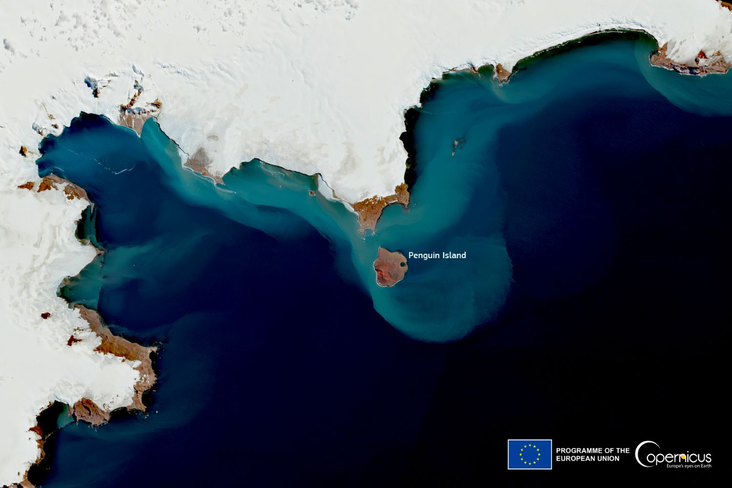
Penguin Island (also known as Georges Island, Île Pingouin, Isla Pingüino, and Penguin Isle) is one of the smaller of the South Shetland Islands of Antarctica. Penguin Island was sighted in January 1820 by a British expedition under Edward Bransfield, and so named by him because penguins occupied the shores of the island. The island, which is ice-free and oval shaped, 1.4km wide by 1.7km long, lies close off the south coast of the much larger King George Island, and marks the eastern side of the entrance to King George Bay. It has a shoreline of low cliffs, with a beach on the north coast providing access. There is a small lake in the north-east. It is capped by Deacon Peak, a basaltic scoria cone. Deacon Peak was last thought to be active about 300 years ago. Petrel Crater, a maar crater, is located on the east side of the island, and is thought to have last erupted in or around 1905. The island is the top of a Pleistocene-Recent stratovolcano within the Bransfield Basin.
The local scenery on the ground is as follows.

Reference: Copernicus EU’s Tweet
See earthview photo gallery: LiVEARTH