NASA’s Terra satellite captured the Po Valley of the northern Italy.
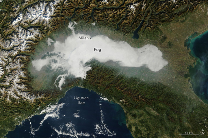
The Po Valley (Po Plain, Padan Plain) is a major geographical feature of Northern Italy. It extends approximately 650km in an east-west direction, with an area of 46,000km2 including its Venetic extension not actually related to the Po river basin; it runs from the Western Alps to the Adriatic Sea. The flatlands of Veneto and Friuli are often considered apart since they do not drain into the Po, but they effectively combine into an unbroken plain, making it the largest in Southern Europe. It has a population of 17 million, or a third of Italy’s total population. The plain is the surface of an in-filled system of ancient canyons (the “Apennine Foredeep”) extending from the Apennines in the south to the Alps in the north, including the northern Adriatic. This view shows the Po River valley under a thick layer of industrial air pollution. The polluted air is effectively trapped by the high walls of the Alps and Appenine Hills, which rise, amphitheater-like, around the valley. As the plume exits the valley it flows eastward into the Adriatic Sea, which from space often appears almost as polluted as the Po Valley itself.
The local scenery on the ground is as follows.


Reference: NASA Earth’s Tweet
See earthview photo gallery: LiVEARTH
Po Valley, Po Plain, Padan Plain, Po River, Italy, イタリア, ポー平原, パダーナ平原, パダーノ平原, ポー川