Astronaut on board ISS captured Zagros Mountains of Iran.
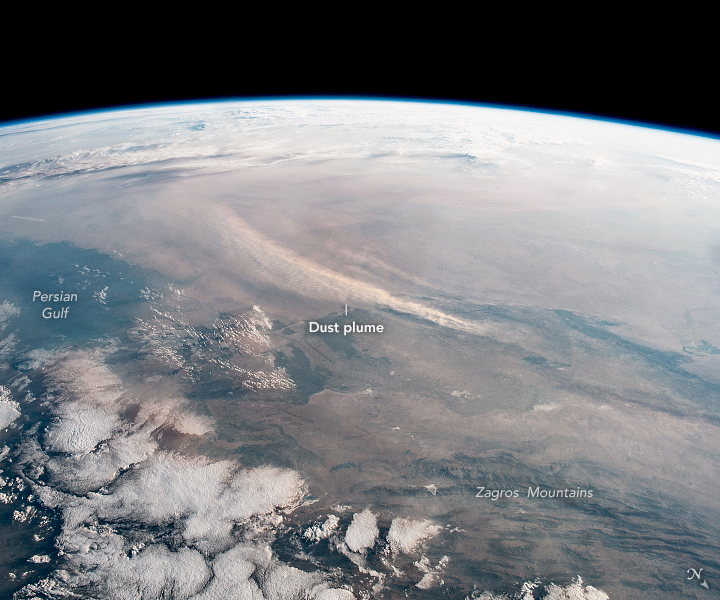
The Zagros Mountains are a long mountain range in Iran, northern Iraq, and southeastern Turkey. This mountain range has a total length of 1,600km. The Zagros mountain range begins in northwestern Iran and roughly follows Iran’s western border while covering much of southeastern Turkey and northeastern Iraq. From this border region, the range continues to the southeast under also the waters of the Persian Gulf. It spans the southern parts of the Armenian highland, the whole length of the western and southwestern Iranian plateau, ending at the Strait of Hormuz. The highest point is Mount Dena at 4409m. The Zagros fold and thrust belt was mainly formed by the collision of two tectonic plates, the Eurasian Plate and the Arabian Plate.
The local scenery on the ground is as follows.

Reference: NASA Earth’s Tweet
See earthview photo gallery: LiVEARTH